The personal authentic travels of a world-wide drifter, you'll always see pics of me at the locations being described (if the other blogs you're reading don't do that, odds are they were NEVER there, just saying…)
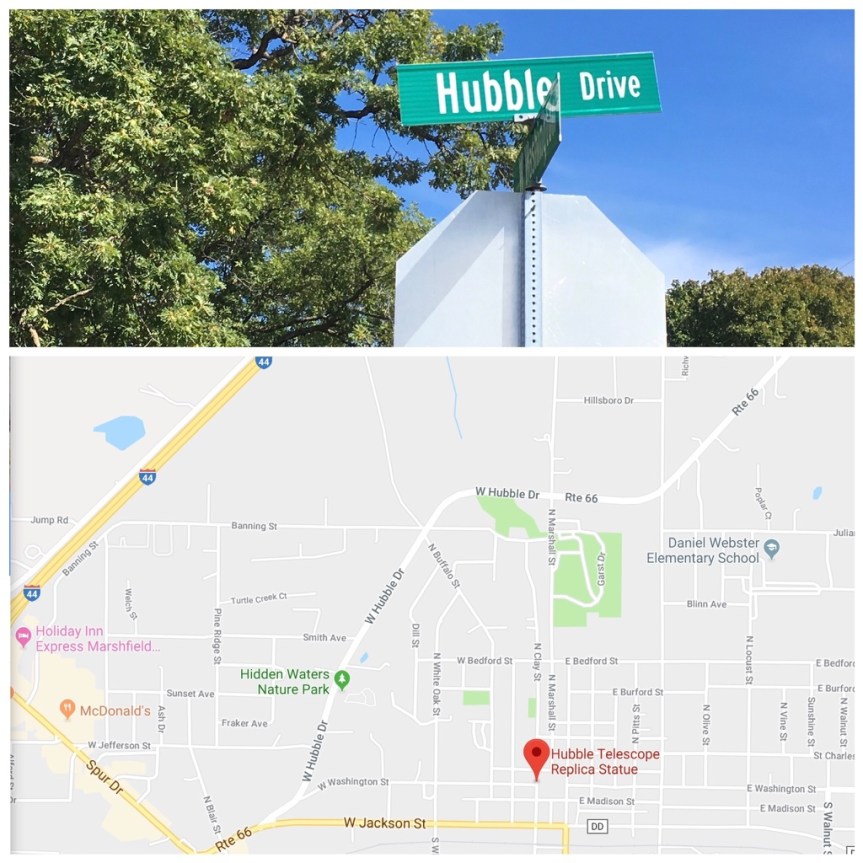
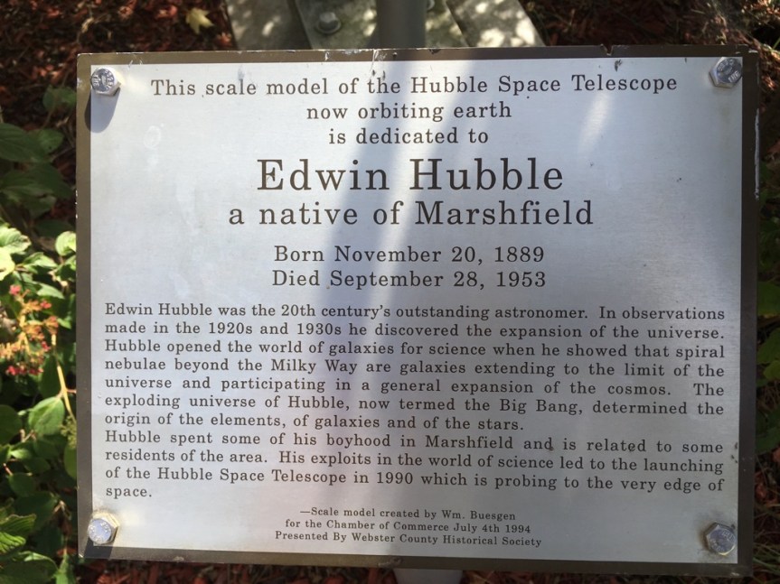
As you’re passing through small town of Marshfield Missouri on Route 66 (population 5,720, so slightly larger than my high school) if you pay attention you’ll realize that within the boundaries of the town the route bears the name of Hubble Drive; this is in honor of the town’s favorite son, the historically important American Astronomer Edwin Hubble (1889-1953)
Hubble is highly respected in the scientific community as one of the most important astronomers of ALL time. He played a CRUCIAL role in establishing the scientific fields of extragalactic astronomy (studying objects OUTSIDE the Milky Way) and observational cosmology (the study of structure and evolution of the universe, not through theory, but through things we can actually see).
And, if you choose to divert just a little bit off 66 to enter the center of town, you’ll find a 1/4 scale replica of the Space Telescope named in his honor (which makes complete sense once you realize who he was and what he did) sitting alongside the town hall.
In addition his efforts are lauded in murals I spotted around town
And YET … Webster Country, where Marshfield is located is a deeply Republican area and voted 76.9% in favor of Trump… And Marshfield is 97.8% lily white…. So what do you want to bet that the old guy is turning over in his grave because most of his hometown’s residents believe science is a bad thing?
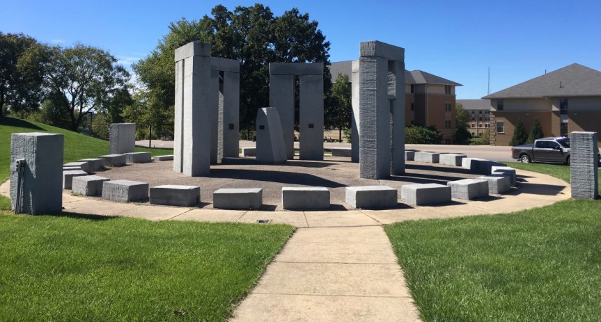
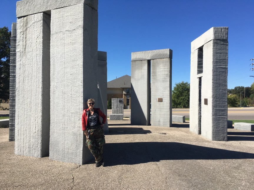
Located right off of Historic Route 66 as it meanders through the town of Rolla Missouri and passed the Missouri University of Science and Technology, is a half sized version of Stonehenge, similar to the one on in Amesbury on the famous Salisbury Plain of England.
Sometimes referred to as the Stubby Stonehenge, according to their website the structure this ‘functional art’ ….
… works just the same way that the original Stonehenge, as a solar calendar… only in this case it comes with annotations in the form of etchings into the stone and plaques placed on the various rocks… and it
“stands for many things; a lasting monument to man’s drive for knowledge and engineering, the largest monument to ever be cut with a water-jet, and a link from the past into the modern. It was dedicated on June 20, 1984 or the summer solstice, at the site of the northwest edge of campus. Approximately 160 tons of granite were used in the monument. The rock was cut to the proper dimensions by Missouri S&T’s Water-jet equipment.”
According to other websites, it was mostly something to do to show off how good their High Pressure Water Jet Lab was at stone carving. Although I also found an FAQ page put up about the place by the University
Somehow I did not spot this on any of the preparatory maps that I used when planning this Route 66 road-trip… so to just happen to drive by it, unexpectedly… it was a super cool surprise…. it made the geek in me very happy…..
Of course this also gives me opportunity to include some images I took back on July 3, 2014, when I was at the REAL prehistoric Stonehenge site near Amesbury … less than a month before my father died. I had gone to the UK to present an academic research paper at a conference at Keele University near Stoke-on-Trent, and afterwards had gone to visit a friend of mine who USED to work for Google in SF (she was on the team the created Google mail) but who had grabbed her golden parachute when her stock options matured a few years before, and had retired to Bristol in the UK, about an hour drive away from Stonehenge.
For an explanation of the fences behind me, keep reading
[My T-shirt reads: “English doesn’t borrow from other languages. English follows other languages down dark alleys, knocks them over and goes through their pockets for loose grammar.” Why yes, I’m a geek, what’s your point?]
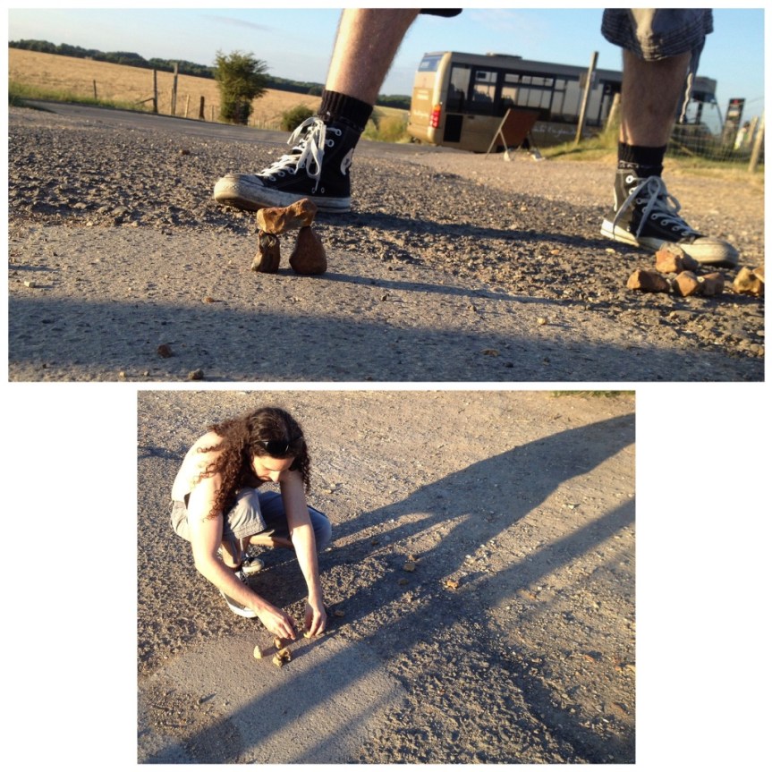
I remember that I got there late, and didn’t make it in time to actually be able to enter the site. I had “assumed” (never assume) that closing time meant closing time… it doesn’t. For Stonehenge the LAST admission to the site is TWO HOURS before the place closes, and they only let in a limited number of people at a time, so unless you’re very lucky, you’ll need to book your visit in advance (from this site), which I had not done… not to mention I showed up a half hour before closing. When I got there the guard refused me entry and told me to come back some other day, and to book my admission rather than just showing up. I almost cried… when I explained I was American and this was my last chance before heading home… he made a suggestion. He told me to drive around the henge area, to a gravel side road on the far side of the tourist entrance, where I would see a lot of other parked cars. From there, he said I could at least see it better. So I drove there… and met this new age-ie guy, making a mini- henge with rocks he found on the road…. [The paved road visible via google maps is NOT accessible to public traffic, it’s for tourist busses only]
There were in fact a LOT of new age types parked along this gravel road… they had a sort of mini community thing going on over there. Since then Folks have even noted its location in google maps, and if you zoom in you’ll see a LOAD of cars along that road, parked for free instead of in the paid lot. They ALL suggested that I walk down to the edge of the official property, at which point there’s a pedestrian accessible wooden gate to his property, with some warning signs on it about keeping your dog on a short leash and respecting that you’re on private property, etc., that opens to a path along the edge of his sheep farm and along the official Stonehenge property … and they promised me that the farmer who owns the place actually wants folks crossing his property to get a closer look — they said it was a sort of “fuck you” to the English Heritage Trust government folks — that was as long as you don’t mess with his sheep.
The view from the location of me in front of Stonehenge, but in the other direction
The ironic thing is… IF you go in the official way, while you do access to the educational tourist center, which is supposedly quite good (I have not yet seen it) … that’s not what you’re paying to see. What you’re really wanting is to get close to Stonehenge — but no one is allowed to do that anymore except on days like Solstice and other Pagan festival day like that. Somewhere we’ve got photos of when my brother and I were very young children (so like 50 years ago) and our parents took us to Stonehenge. In them you can see him on one of the rocks (I was still a toddler). But those days are LONG past… Today, ironically, the distance between this free path, and the path you’ll be paying to walk along is little enough as ‘never mind’. That said, the free way limits you to one side of the henge, while the paid path takes you all around it… but pretty much at an equidistant.
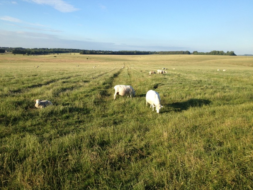
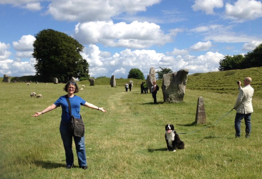
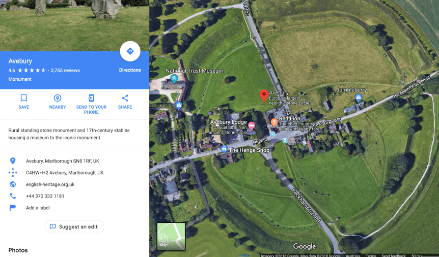
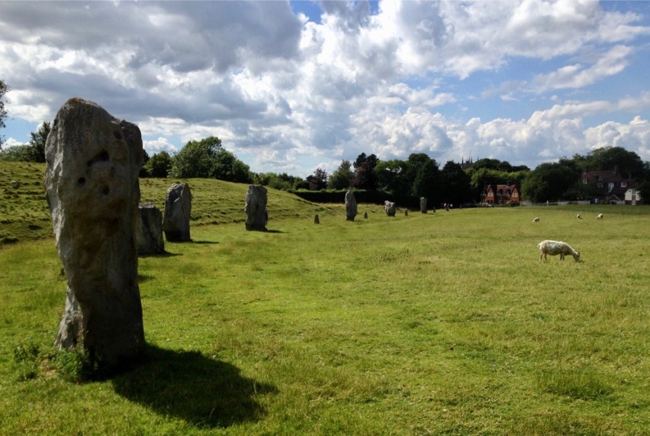
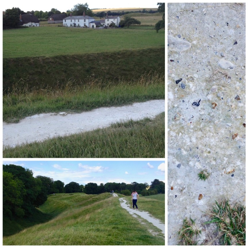
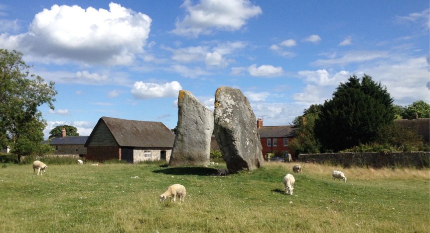
That said, three days later on July 6th, 2014, my friend who I was staying with in Bristol (she’s the one standing, wearing a backpack, with her back to the stone in the picture above) took me to an arguably more interesting, albeit less famous, prehistoric henge directly north of Stonehenge in Avebury, on what is debatably the northern edge of the Salisbury Plain (the actual edges of the plain are up for debate). This henge, which the public can STILL visit entirely for FREE and get up close and personal with the stones, is actually the largest Neolithic stone circle in Europe (in terms of ground covered). Unlike Stonehenge, which has the largest stones and as such is famous for the “how the fuck did pre-technology man get stones this big to this location?” question, that has in the past made people think aliens must have done it… This henge consists mostly groundworks, that encircle very large stones (but of the, “ok, I can see how primitive man working together might have moved these to here” size).
Here, and I was shocked when I first realized this — and you can’t but, I noticed it as soon as we drove to the location, the village actually cuts THROUGH the center of this historic henge, so that some homes actually have henge rocks in their gardens….
Note the road I was on when I took the photo cuts right through the circle, and the shot below is of the same location from a slightly different angle (you can tell from the church spires) only in the 2nd one I was up on top of one of the ground-works
In a way looking at these is sort of bitter-sweet for me. Unbeknownst to me, my father was having real health issues back in the states but he refused to tell me about them because he didn’t want me cutting my trip to England (he was British by birth) short on his account. MEN!
As is obvious from the above picture, this prehistoric area is actively used by locals for hiking and picnics, etc.
and it’s really easy to see how the ground was worked by prehistoric man, with both dug trenches into the chalk ground (which must have been very hard work) and then used that to make man-made mounds surrounding them
The top of the man-made mound, and the chalk exposed as a result of folks walking thereWhere these holes part of how they lifted and carried the rocks?
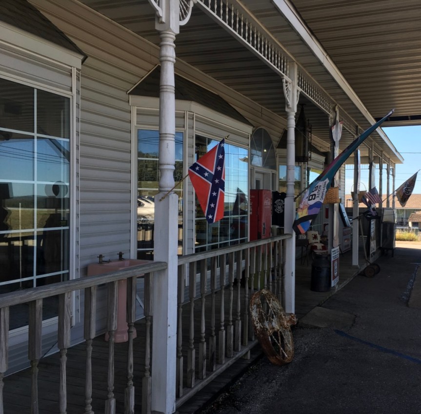
Located in downtown Rolla Missouri is the Totem Pole Trading Post which advertises itself as the oldest Route 66 business in Missouri.
According to various websites, the business has up and moved over the years, as Route 66 has changed routes.
I am not sure if it’s actually the oldest ……
but I saw that flag when I walked in… I looked around (they were mostly selling a load of highly embarrassing junk… seriously. One wonders how they stay in business)…. I asked the guy if I could use his bathroom, I took a dump… flushed and left….
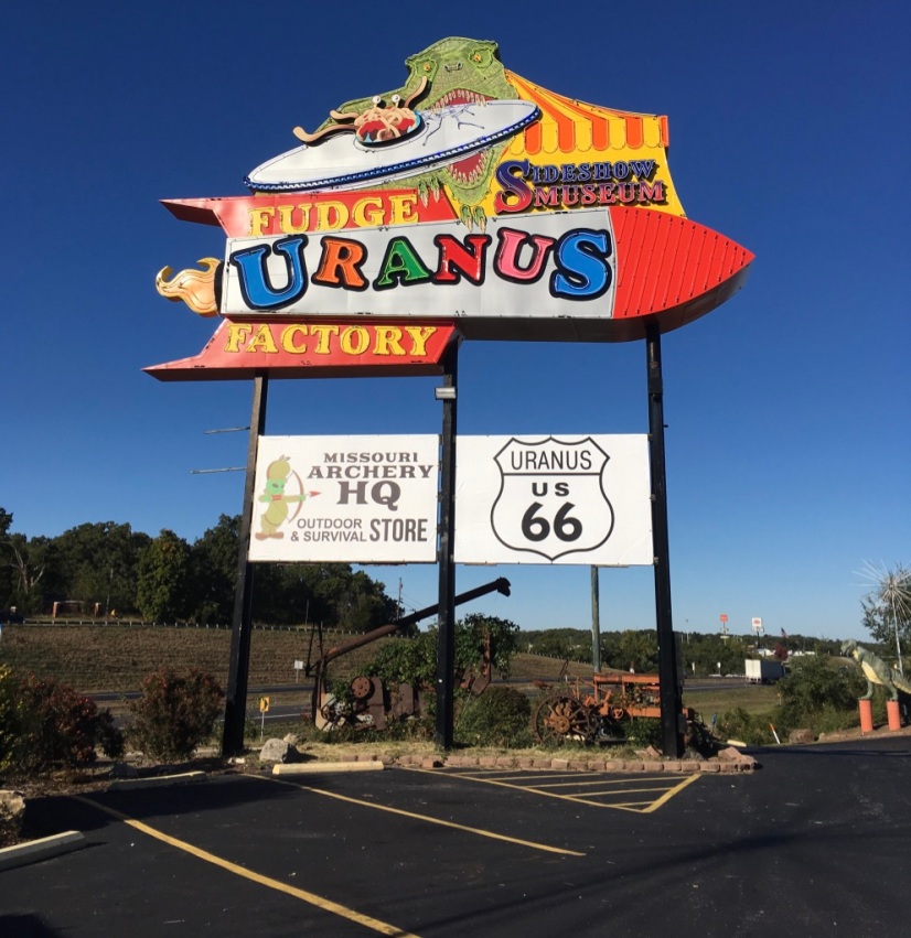
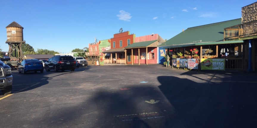
Located on Route 66, this place was advertised as a town that had taken its name and run with it…. unabashedly. This appealed to me… That said, the place turned out to be SUCH a major tourist trap that it managed to lack ANY charm, wit, or finesse at all, and the joke … which I admit totally made me want to come see the place, gets REALLY really old after the first 15 minutes of actually being there… to the point of irritating.
From everything I had read the place was a very small town with 25 residents. AND, having just driven past any number of very tiny towns along route 66, that is what I was expecting… 25 residents maintaining a few business all of which played on the name of the place in order to draw tourists to somewhere they’d have otherwise just driven through… All hail the entrepreneurial spirit!
Note, the parking lot concrete is stamped with the words “Explore Uranus”
BUT, once I got there, it was very sad… Firstly, as you can see from the pictures, it’s not really a town. I was expecting a small town… a downtown with a handful of business, surrounded by a few houses… like all the other aforementioned small towns I had passed on Route 66…
Instead what I found was a massive attraction that looks like a strip mall tourist trap …. essentially a single business broken into a few separate areas….which is not just unforgivable… it’s lazy. When you arrive you see the fake water tower, intended to make it feel like a “small town” with the implication that they have a school somewhere back there, with team called “the Pirates” — but I think they’re referring to themselves… as in the way Carneys think of the customers as marks to be taken advantage of… only these guys are pirates ripping off the sea of traffic…
What was doubly frustrating was that in the gift store they have lots of magnets focused on the town’s name…. but no bumper stickers (my car is COVERED in bumper stickers)
… When I asked about that the woman working there said that up until now everyone’s wanted magnets, so they ordered lots of them… but now people are starting to ask for stickers, but those they haven’t gotten in yet… (not sure I believed her)
and apparently, just recently a big group had come in and bought out all the good women’s T-shirts (scoop or V neck) so there were none of those either — and definitely none were available in the only design that I was interested in buying — as apparently I’m not the only woman who preferred that design. She suggested I check their webpage over the coming weeks — I did, and didn’t see it there either.
By the time I was done walking around the place… and I admit I stayed longer than I might have had I not been intent on writing about the place, because this place seriously annoyed the CRAP out of me … just … that… much!!! … by the time I got done, I was seriously…. SERIOUSLY pissed at having fallen for this particular tourist TRAP
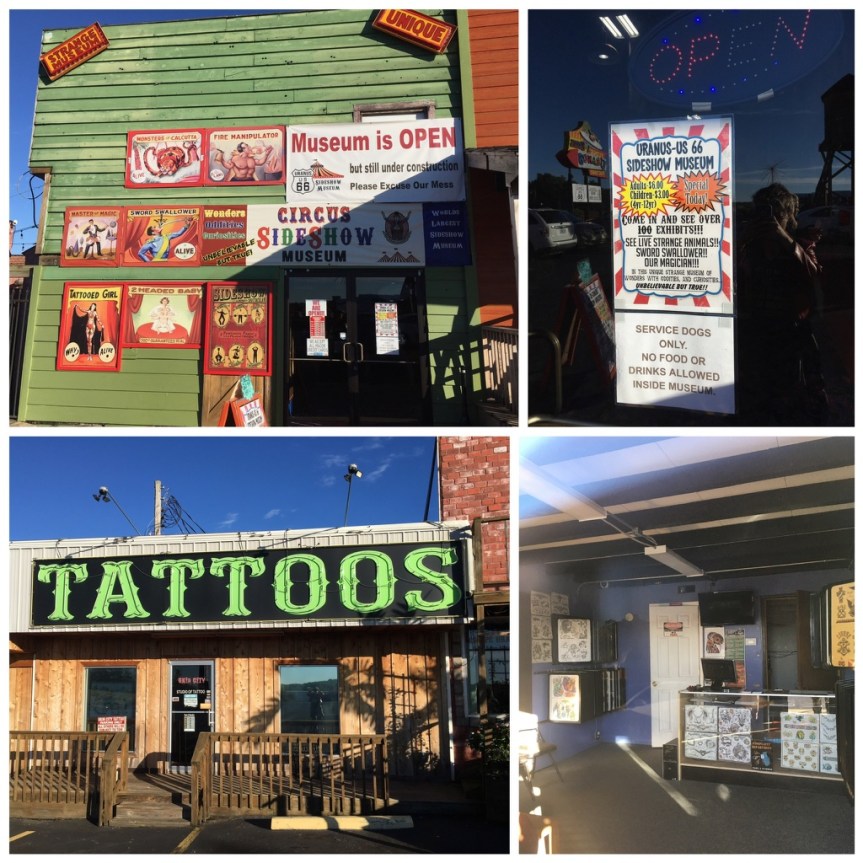
There’s also a circus sideshow museum and a tattoo parlor
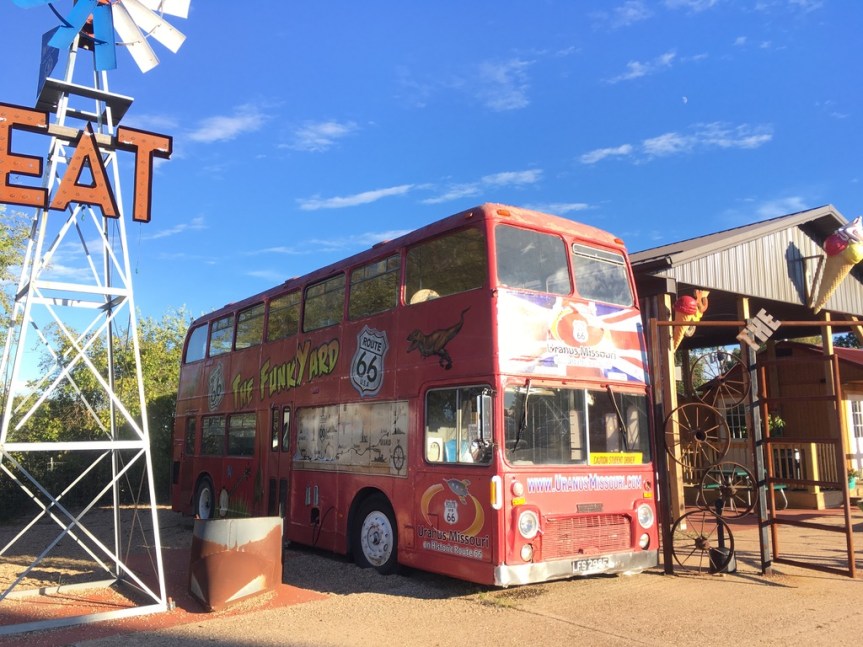
SO annoyed in fact that I managed to completely miss the fact that around there somewhere (according to Wikipedia) they’ve got the World’s largest Belt buckle … one that even has a Guinness World Book of records designation… yah, I missed that… saw the Funkyard where it’s supposed to be…. did NOT see even one sign promoting it…
Pounding head into wall… will have to go back… pounding head into wall again… THAT said, I’m not seeing it on google either…
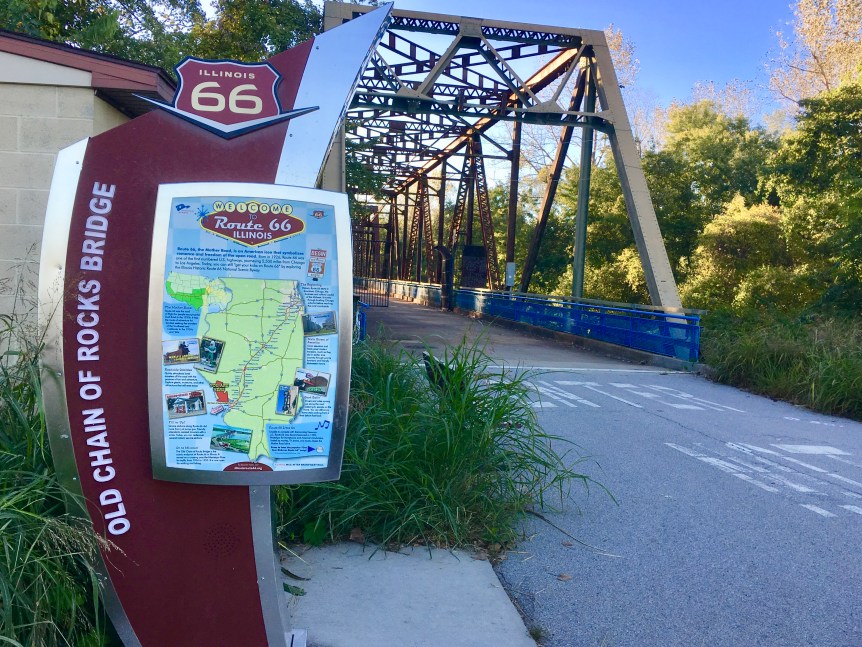
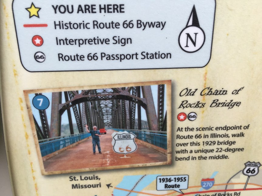
Privately built as a toll bridge across the Mississippi River in 1929, The “Chain of Rocks” was part of the designated Route 66 city bypass beginning in the late 1930’s, and is on the National Register of Historic Places. When you see it, the reason why the bridge was retired is obvious, it’s only wide enough to allow a single line of cars headed in one direction to pass over it at a time. As vehicles are no longer allowed over the bridge, it is now (by default) one of the world’s longest pedestrian bridges.
It’s name comes from its location along the river. Previous the 1960’s when the United States Army Corps of Engineers built a low water dam to correct the problem, this area was actually the sight of river rapids that made navigating this stretch of Ol’ Man River very dangerous indeed.
That said, when the bridge first became the designated bypass, the Route 66 traffic that WAS willing to pass through downtown initially took the more southerly MacArthur Bridge, located just south of where the I-55 crosses the Mississippi… although that only the first of the bridges, as route 66 traffic was continually being re-routed….
As I’ve said repeatedly, when you are in this part of the country, being able to “drive 66” becomes a questions of WHICH 66 you want to travel on… there is not just one… simply to cross the river there are FIVE different options.
… the best place to access the bridge is on the East/Illinois side of the Mississippi rather than West/Missouri side. On the east side there’s easy parking dedicated to those wishing to walk across the bridge (with I might add police protection there around sundown), while on the west side there is no dedicated parking lot
When you first approach this area (heading west) you’ll pass over a shorter, cars traveling in one direction at a time, bridge that is still functional. This one takes you from the Illinois side to Chouteau, a man-made Island that when I was driving through it seemed like it was being used as garbage dump, but apparently its being converted into a recreational area. You then drive to the other side of the island, directly into the parking lot for the Chain of Rocks bridge.
If you look at google maps, the area directly after the gate (behind me) is green on the map… it’s not land so much as it’s swamp. As I mentioned before this section of the river was called chain of rocks because it was shallow enough that it had rapids before the corps of engineers fixed things… this was done in part by digging out the middle of the river, and this island was created with the mud …. but the first section of the Chain of Rocks passes over “land” that is still shallow and swampy
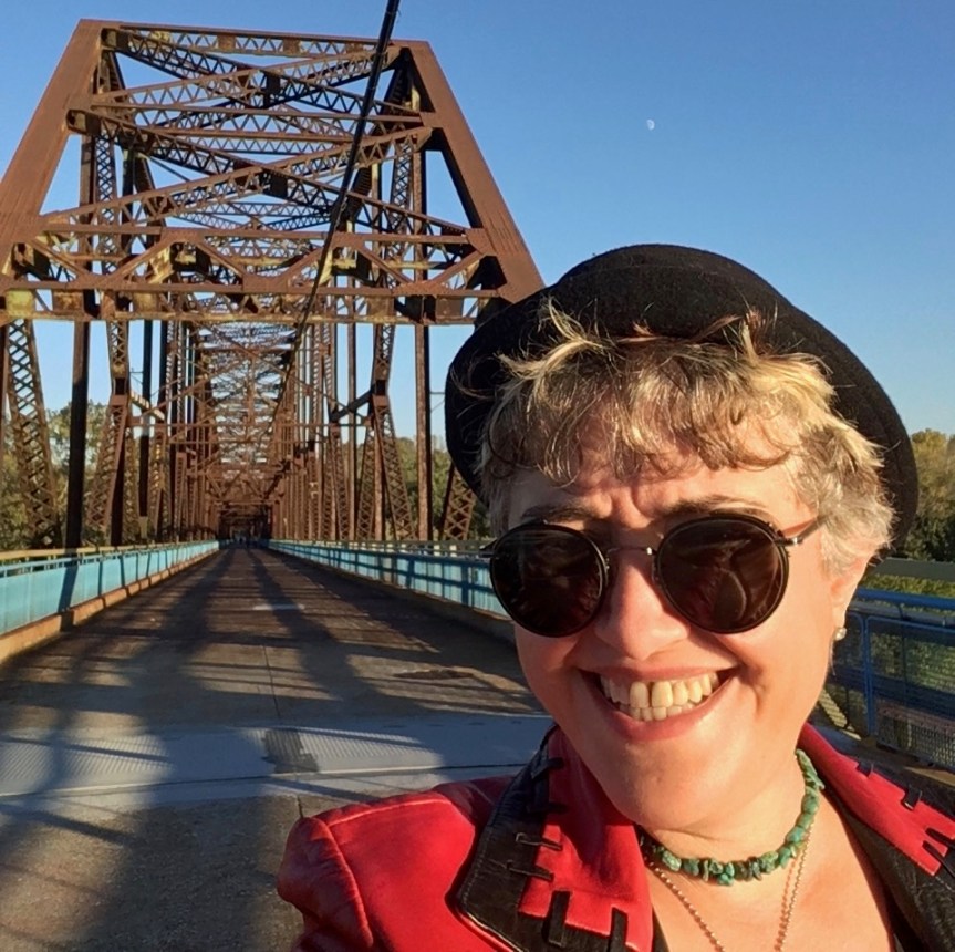
After you’ve walked for a bit — and its was a very lonely walk (it actually made me very nervous walking across it by myself, as it could have just been me and G-d knows whom else on the bridge, in a location where there’s no one to hear you scream) you finally pass the swamp land into the wide River
A 2nd word of warning… This bridge see’s so little traffic that the spiders seem to have taken over ownership of the place and humans are just intermittent visitors. It’s not just spider webs along the sides, as that is to be expected.
Rather, it’s that as you along it every second or third step you find yourself walking into yet another strand of spider silk … as in THOUSANDS of them live here — this is NOT a place for anyone suffering from Arachnophobia.
Over the course of the whole walk I saw only 6 people… one middle-aged woman walking alone (which made me feel much more secure) the group of three young people walking towards me in this shot, and then as I was leaving, middle aged couple who were smoking pot.
And from the above photos you get a sense of just how far from downtown St. Louise the bridge is…. that odd-looking thing is the Gateway Arch from a bit of an angle.
And no, I didn’t get all the way to the bend, the sun was going down and I was worried about getting caught out there when it started going dark.
The Wagon Wheel Motel in Cuba Missouri is both one of the oldest historic motels along Route 66, and of them the only one to have been continuously operating since its opening. From the outside is actually pretty idyllic. It is built in the Tudor Revival style out of Ozarksandstone. It opened initially as a cafe and filling station in 1936, and then expanded into a motel in 1938; and it is listed on the National Register of Historic Places.
The motel consists of a collection of very cute looking homes with stone exteriors, that sits behind a larger main house
In front of which are some historic gas pumps (but gas is no longer sold here.
When I arrived, the main building was undergoing some regular maintenance/cosmetic upkeep repairs, which is in keeping with the whole “Viva Cuba” project that I discussed in my recent post about the town of Cuba itself. Inside the main building was a check in counter, and an unusually large gift store — taking up the area that I’m guessing originally housed the cafe.
The Motel was apparently fully renovated in 2010, but looking on-line I found some very mixed reviews… A lot of folks love the place, but those who didn’t were vitriolic, saying that it is one of those motels that looks a hell of a lot better on the outside than supposedly it looks on the inside. But like I said, MIXED reviews, and I haven’t stayed here so I can’t comment personally.
I asked the woman who seemed to be the owner “are you renovating the interiors too or just the exteriors?”, and she said “yes, you can go inside and shop” …. On the upside, the gift store was selling route 66 T-shirts that were specific to the location, rather than the generic crap that has annoyed me for most of the my route 66 Trek
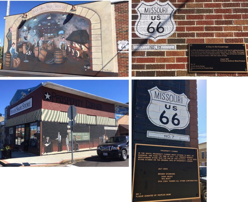
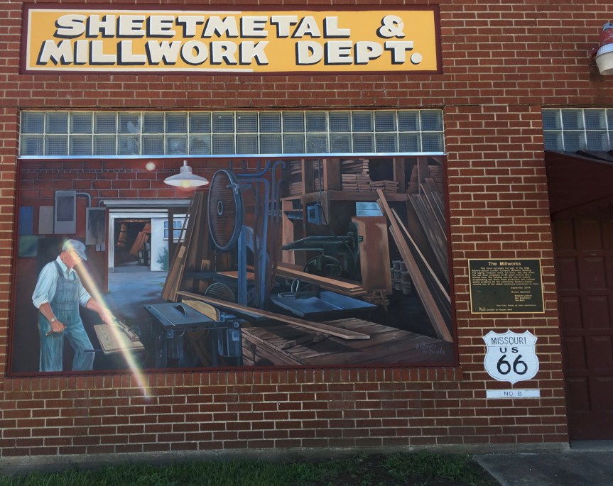
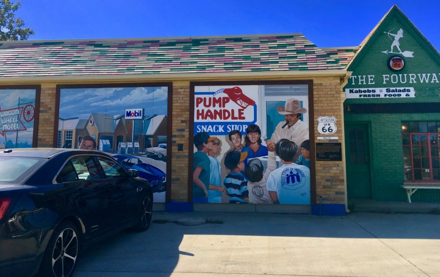
Cuba Missouri is yet another small town that has discovered the economic value of public art. It is the largest city in its county, with a population smaller than my high school had when I graduated, and yet it’s on every “MUST SEE” list for travelers traversing Route 66.
A local bank funded the “Viva Cuba Project” in 1984 because while trying to lure potential investors into the town, that they were being turned off by the high percentage of eyesores… and realized that a city beautification project was needed in order to spur economic growth. This initially involved businesses investing in beautifying their business and the city investing in trees and shrubs and various landscaping projects. So for instance check out this incredibly cute cafe, The Fourway (Kabobs, salads and fresh foods) in what has to be the cutest re-use of a historic gas station that I’ve seen so far.
I can’t review it as a restaurant’s food as I didn’t eat here, but I was tempted, SO CUTE
The Mural phase of the city’s beautification project began in 2001 and was completed in 2007. It was the Missouri legislature which designated the city the Mural city or Route 66… which I think a lot of the other small towns on 66 in other states, that have also gone this route, may take issue with.
I noticed however that the murals, for the most part, face east…. so the artist is assuming that most visitors who are traveling Route 66 are headed west.
Betty Davis Apparently visited the town once, and this mural honors that visit
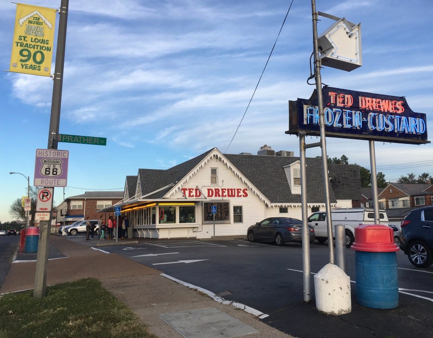
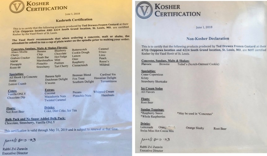
Ted Drewes is a family owned Frozen custard business and a Saint Lewis Missouri institution. Founded in 1929, it’s Route 66 location is historic, and it has been included on Food shows by the likes of Alton Brown and Bobby Flay, and in 2017 was awarded the title ‘Best ice cream shop in the world’ by Soolnua, a company that every year produces a world-wide “best ice cream” index. (Wikipedia)
If you’ve never had frozen custard you really need to try it. While the rest of the world is only now discovering it, its capitol” if you will is Milwaukee, Wisconsin, and it is a fairly common treat all throughout American’s Midwest.
It’s essentially ice cream with egg yolks, and as such has a creamier texture, and can be kept at a warmer temperature without melting than ice cream… all while still managing to have a denser consistency. AND Frozen Custard is lower in fat than Ice Cream is, and as such is a lot lower in calories, while having more protein. Seriously… it’s a win win
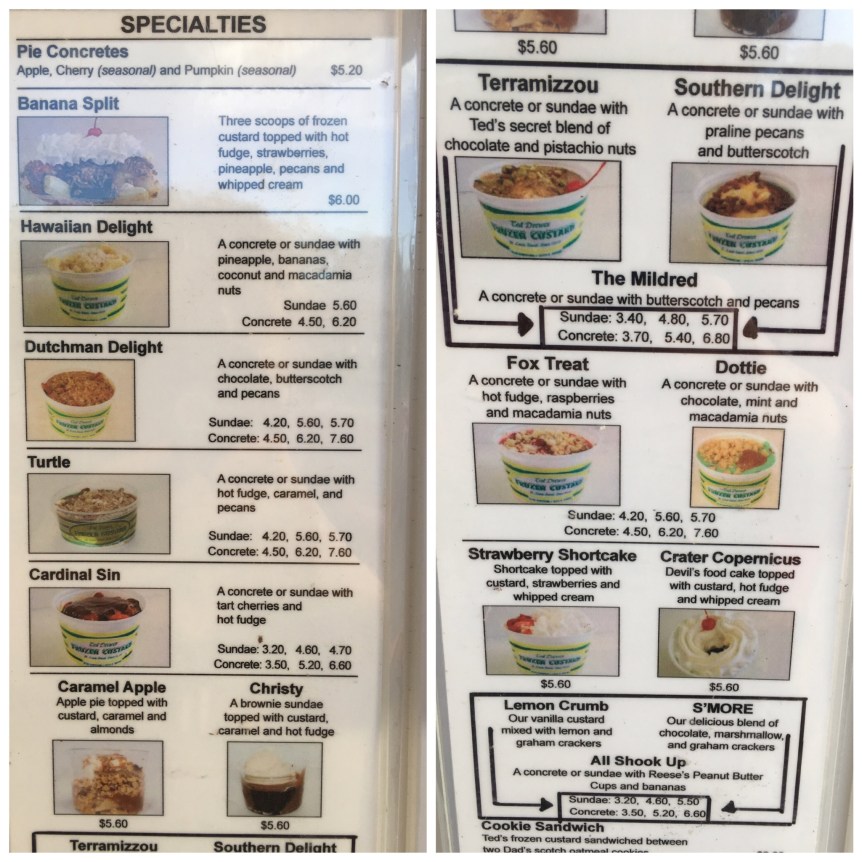
Frozen custard comes in vanilla only… any flavors are added after the fact, cherries, nuts, caramel, what ever you want from their available list… with each extra adding to the price…
… or from the flavor combos they suggest…
and then, if you’ve chosen to have a concrete (rather than a sundae or malt, etc.) then, just like in a milk shake, the flavors are blended into the vanilla custard, served in a cup and handed to you…. but they hand it over up-side-down, in order to prove to you just how THICK your treat is
I ordered the Cardinal Sin, it was very tasty
One thing that I found personally amusing was that Ted Drewes Frozen Custard is KOSHER… well… most of what they serve is….
It’s a fork that is 35 feet tall, and stands in Springfield, Missouri outside of a nondescript office building that is the home of a website called The Food Channel (not to be confused with the The Food Network).
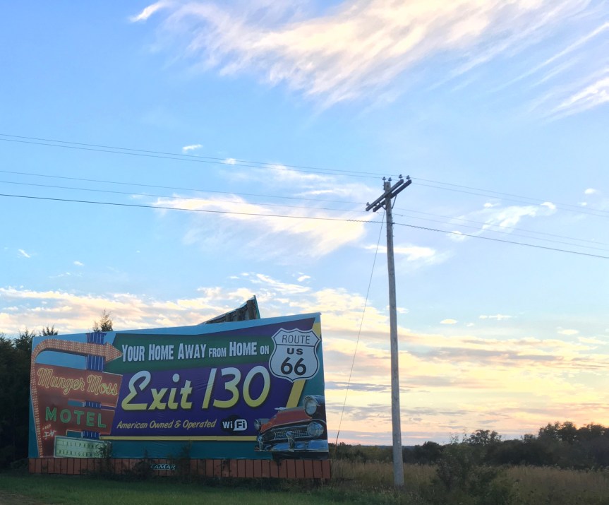
Passed this Route 66 Icon, the Munger-Moss Motel… which is celebrating 72 years on 66 and stopped to snap a picture.
You know you’re looking at a historic motel when the neon sign advertises, “Free TV”
That said, later while driving on 66 I passed a roadside sign (aimed to be seen by the drivers on I-44) advertising the place
Scanning through the reviews (google, yelp, tripadvisor, etc) apparently this is one of the better cheap places to stay. It has 1950’s decor and the sort of privately owned place where you need to arrive before the owner goes to sleep.


 What was doubly frustrating was that in the gift store they have lots of magnets focused on the town’s name…. but no bumper stickers (my car is COVERED in bumper stickers)
 and apparently, just recently a big group had come in and bought out all the good women’s T-shirts (scoop or V neck) so there were none of those either — and definitely none were available in the only design that I was interested in buying — as apparently I’m not the only woman who preferred that design. She suggested I check their webpage over the coming weeks — I did, and didn’t see it there either.
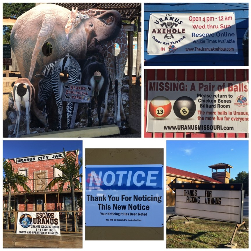


 The Mural phase of the city’s beautification project began in 2001 and was completed in 2007. It was the Missouri legislature which designated the city the Mural city or Route 66… which I think a lot of the other small towns on 66 in other states, that have also gone this route, may take issue with.