The personal authentic travels of a world-wide drifter, you'll always see pics of me at the locations being described (if the other blogs you're reading don't do that, odds are they were NEVER there, just saying…)
Category: Trail of Tears
The National Trails System currently consists of 30 National Scenic and Historic Trails, one of which is Trail of Tears National Historic Trail commemorating the forced relocation of the Cherokee People from their homelands in Georgia, Alabama, and Tennessee to the “Indian Territory” (now Oklahoma). They traveled by foot, horse, wagon, or steamboat in 1838-1839, and unlike some of the other National Trail systems, this is not one simple trail, but rather a collection of them which pass through the present-day states of Alabama, Arkansas, Georgia, Illinois, Kentucky, Missouri, North Carolina, Oklahoma, and Tennessee. https://www.nps.gov/trte/index.htm
In October, while driving Route 66, I came across this marker/monument in Oklahoma. It denotes the eastern boundary of the Oklahoma Land run of 1889. For those who are unfamiliar with this event, it is yet another one of the many moments in American history where white men feel proud of themselves (there’s a HUGE monument to the event in downtown Oklahoma City), for essentially screwing over the indigenous red man who was there first (please note there is NO reference to them on this monument). HOWEVER, it also has something to do with the Case of Carpenter v. Murphy which is currently before the Supreme Court of the United States!
In fact the Run of ’89 was the first of a series of land rushes organized by the Federal Government. These were “organized (HAH!)” events where vast numbers of WHITE settlers, 50,000 of them in this case… lined up with a flags in their hands, and at the sound of a gun were supposed to surge across the UNASSIGNED countryside on horseback or in wagons, racing to outpace the other contestants, find a nice piece of desirable FREE land, drive their flags into said piece and thereby “stake their claim to it.” In reality, the gullible honest people did that… often to find cheaters (usually rich people who had illegally surveyed the land ahead of time) already there (along with all their employees) trying to make it look like they’d actually done the run along with the others… when they had not… and had somehow managed to grab all the best bits of land first. So this was not only White people screwing over Red people, it was also rich white dishonest people screwing honest hardworking poor white people.
Of course, all of this screwing was only possible after the government had “legally” screwed the folks who were already there…. the Native Americans…. Initially this was done via the Indian [land] Appropriation Acts where the government gave itself the right to yet again round up the local Native American population, this time to force them into reservations. When I say yet again, you need to keep in mind that the State name, Oklahoma, is derived from what it had been called at that time… i.e., the Oklahoma territory… and that the word Oklahoma is actually a composite of the Choctaw words “okla” and “humma,” which translates quite literally to “red people” … i.e., Red man’s territory.
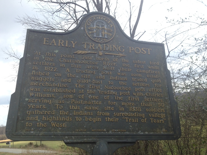
This was an area that had at first been occupied by the Choctaw Nation (a multi-tribal people that spread from Oklahoma to Florida, and were united by a single language, Choctaw), who were then joined by the Cherokee… who were only there because they had already been moved once. Some came begrudgingly, as a result treaties they had signed, such as that of New Echota — the one made with the leaders of the former capitol of the Cherokee people( which I had visited twice, located about 1.5 hours from my friend home in Dalton, Georgia) with the Federal government; and if individual Cherokee refused to go by choice, they were FORCED to do so, on what later became known as The Trail of Tears. Ultimately, all of the Native Americans living within “Indian Territory” had been members of what the American colonists had referred to as the “Five Civilized Tribes“….Native Americans groups from along the southeast sections of America who had tried to get along with the invaders by going along; groups who had converted to Christianity, adopted centralized forms of government (see my posts about New Echota), were literate (see my post about Sequoyah), participated not just in trade but in the market economies of their areas, AND, to top it all off… OWNED SLAVES (see my post about Chief Vann, who maintained a plantation just north of Echota). All of these tactics of compromise ultimate failed, and now… having already been relocated to Indian Territory — which was supposed to be JUST for them… they were removed yet again, forced into reservations, and what had been their land, was now deemed “unassigned,” was given away to white people… who grabbed it in the mad rush described above.
And the bleeding of the tribal lands in Oklahoma has in fact continued to this day so that only 2% of what had been Cherokee Nation land is still under their own control. Now here’s the good news… AFTER I had already driven past this area, on November 27, 2018 the Supreme court heard a case called Carpenter v. Murphy that calls into question whether the tribes of the Five Civilized Nations STILL have sovereignty over its own people on lands that had sort of bled out of their control within the Indian Territory lands in last 100 years.
The word Oklahoma actually translates in the Choctaw language to “red-person,” specifically, ukla=person and huma=red, and the entire territory had initially been ‘given’ by the US government as a territory intended solely for the tribes… and it is where the tribes from the southeastern states were marched towards on the Trail of Tears.
This Memorial located directly upon the old Route 66 route marks one of the boundaries of “Indian Territory” a continually shrinking zone that the American government promised to leave to its native populations that at this point is more easily observable via the names of places than on the faces of its occupants.
The Hermitage is the home of Andrew Jackson, America’s seventh (from 1829 to 1837, he served two terms) President of the United States, and possibly one of our most controversial ones. To put it in a modern context, Trump is a big fan of Andrew Jackson, and a lot of people compare the two Presidents as being similar, and will view that similarity with the same intensity of love and or hate for the man, depending on their political leanings.
How people viewed President Jackson is part and parcel with the nicknames they gave him. So for instance his names among the whites varied from “Old Hickory” which was given to him by the soldiers who served under him and loved him, to “The Hero of New Orleans,” because of his successes in the Battles for New Orleans (December 14, 1814 and January 18, 1815) as part of the War of 1812, notably his wins happened AFTER the treaty ending the war had already been signed (December 24, 1814), but apparently that didn’t (and still doesn’t) matter in the minds of his supporters … to “King Mob,” by his white detractors, because his most avid supporters for position of President were considered the illiterate mob. While the names the Native-Americans gave him included “Sharp Knife,” given to him by the Muscogee/Creek people, or his even more explicit Cherokee name of “Indian Killer.”
So for instance, during my travels I’ve spoken about the Trail of Tears in numerous posts, and that act of genocide was initiated by the state of Georgia, but could never have happened but for Jackson’s who hearted support … His supporters (current day hard core republicans) will often point to his high respect for the constitution, and how he said, “The Constitution and the laws are supreme and the Union indissoluble” when speaking against a state’s right to secede from the union, but seem to completely forget that the Cherokee had fought their forced relocation by the state of Georgia all the way to the Supreme Court and won their case, only to have Jackson, who had as part of his campaign promised to support Indian removal (the same way Trump has promised to kick out illegal aliens and build the wall) completely reject the court’s findings, “supposedly” saying (but probably didn’t) “John Marshall has made his decision; now let him enforce it!” and then instructing the US military to forcibly remove the Cherokee anyway.
And yet, Andrew Jackson was a man of the people. In a government that had till then been run almost exclusively by men from America’s “best families,” essentially our upper classes … Jackson was quite the opposite. Without him Lincoln might have never been elected. The illiterate and unwashed populace supported him because he was one of them, hence the title “King Mob.” And even some of our most iconic liberal media TV shows, like The West Wing, are therefore forced to tip their hat to him.
My first visit to the Hermitage was in December of 2010, and there was snow on the ground. To be honest my desire to come here again was so I could blog about it here as part of my visiting sites around America related to our Presidents and First Spouses (in fact I’ll be doing more Lincoln stuff in a few days) and to see if there were any changes to the place. And there had been, although nothing particularly substantive.
When you first enter the property, you are now given a choice between two different sorts of tickets. The major difference being, one includes the older audio device for self guided tours (audio, but no pictures), while the new one includes a sort of smart phone like device, which adds images, a few more narrations with more information (much of it about relationship between Jackson and his slaves), and a 10% discount at the store which I wish they had actually told me about when I paid for the thing, because I bought about $80 worth of costume jewelry while there and that $8 discount would have paid for itself (I only just discovered it now).
In the photo on the bottom left you can see a staff member demonstrating how to use the older audio device (on the wall behind her were the three sorts of tours information), while on the bottom right is one of the new smart-phone type machines, which is what I was using. Regarding the sorts of information offered, I found two things interesting: firstly, On adult devices do NOT allow you to hear the blue 200 series audio files, intended for kids, so that as a parent you can’t actually know what they’re telling your kids, or NOT telling them… that’s a problem! Also, if you think about it for a second, you get the feeling that the 300 series, the information about Andrew Jackson’s wife was added as an afterthought … as part of the whole, we need to pay as much attention to the first spouses as to the presidents movement.
After getting your headsets, or before, depending on how you time things, there’s short movie that provided a fairly level introduction to who Jackson was, pointing out that he could be mild-mannered and polite, as long as you didn’t get in the way of anything he wanted, in which case he could turn extremely violent, and you were essentially dog meat. (There’s a world for this, its psychopath … no I don’t have an opinion about this, why do you ask?)
After the movie there is a small museum area you can either walk straight through on your way to see Hermitage, or you can stop and appreciate, which will teach you more about the man and his importance to American history.
After the museum you begin to the approach the property, and this is when the audio aides come into use.
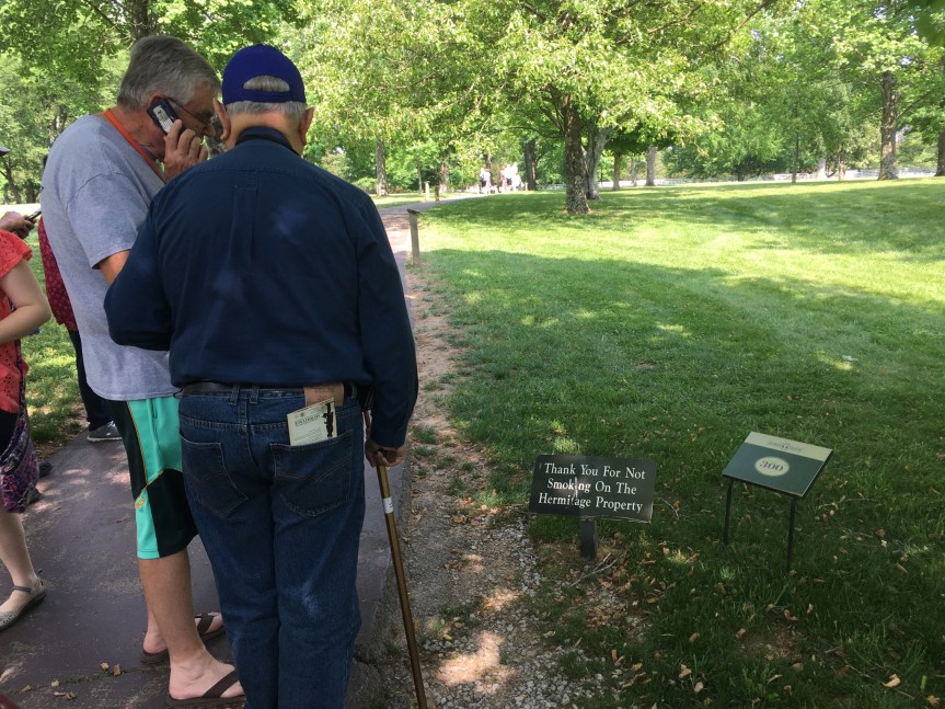
All along the path there are detailed signs you are meant to stop and read that offer other information (not available in the audio segments)
And then after you’ve walked a short but winding path you begin to approach the building itself, and are offered information about its building and evolution over the years before, during and after Jackson’s presidency.
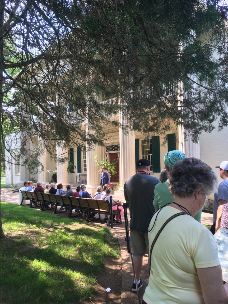
Then, you stand in a cordoned off line, and wait for your turn to enter the building. For this they’ve come up with really smart way of breaking the tourists into easily manageable groups. There is a set of benches, and only as many people as can comfortably sit on the benches at once are allowed in at a time, and each group once seated is given a short speech about what they’re about to see, with a question period after it, all of this intended to space the groups out.
One difference I DID notice between this time and my previous visit in 2010 was back then ALL the various tour guides were dressed in period costumes, while this time they all were wearing modern clothes. (I think this change is a loss)
Note the difference in cloths of this guy (in the black outfit) in this picture taken in 2010 with the young guy in the picture taken yesterday
Additionally, and this I’m less sure of, last time I’m pretty sure that the same docent stayed with our group along the whole tour, while this time we visitors were moved from one location to the next but the tour guides stayed put.
Both times, while in the house, we were not allowed to take pictures. However, I think this was for two reasons, firstly, picture takers can slow down the efficient movement of people from one location to the next, and secondly, picture takes tend to break the rules in favor of a good shot… crossing boundaries and using flash (which could have a cumulatively destructive effect on the antiques in the house).
But once you’re outside of the shuffled through tour part, there’s not only no one telling you NOT to take pictures, but there also plastic walls in place separating you from any chance to do anything destructive… via the servants section of the house where you can see into the main house … so… here are some.
This was the informal part of Jackson Parlor. In the Front rooms, which are not directly visible from the servants area is where he met official visitors, this back room was where family would spend their time
This is the dining room. The flooring which looks like linoleum is actually a waxed cloth (like wall paper for floors) that was popular at the time and even existed in the White House. The stove was a modern Franklin stove which was much more efficient than a fireplace.
The home would house any and all visitors who came that day (as at that time it was a couple of hours ride away from Nashville), offering them a place for the night. Bed rooms were filled on a first come first serve basis, separated by gender, with late comers given bedding on the floor, as was the common courtesy of the day. (There’s actually an amusing story of one time Thomas Jefferson while running for President went to visit the then widowed Martha Washington in Mount Vernon, and she hated him so much while she could not refuse to see him, she did not, as was considered common courtesy, offer him a place for the night… and he was forced to ride all the way back to Alexandria. A MAJOR diss… we know this is true because apparently he ran up quite the liquor bill that night at the inn he ended up in)
After dinner, the dinner table was designed to be easily taken apart, and the dinning room was then available for dancing and other entertainments. Right behind the dining room is of course the servants area, such as the kitchen and store rooms
Another change I noticed was, while last time I was here, people would press the various buttons (like the one here in front of the kitchen) to listen to the recording describing the area, which was blared over a loud-speaker to the whole group at once, this time NO ONE (other than me) pressed these buttons. In fact I spotted one woman bitching to a guard that I had disturbed her by doing it… to which I’m pretty sure he responded, “Madam, that’s what they’re there for.”
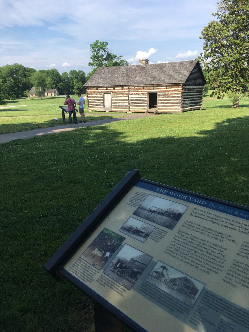
After the house you walk to the fields, work houses and slave quarters that are located in the backyard area
A view of the house from the back, less fancy than from the front
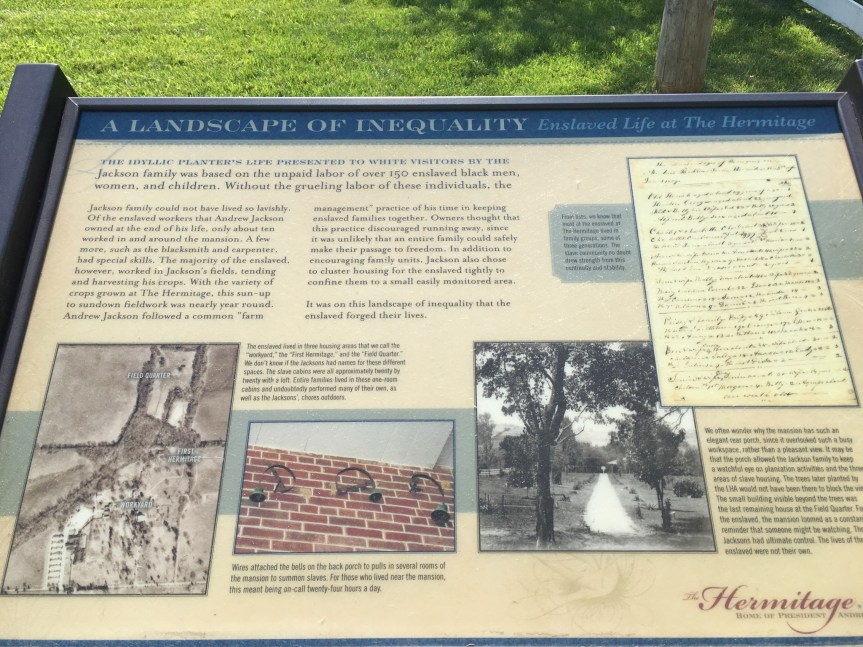
One of the interesting things that I learned was that while one of the horrors of slavery you always hear about is families being separated, it was NOT Andrew Jackson’s practice to do this. Whenever possible he kept slave families together even to the point of it not being economically practical (holding on to the very young and the very old), to the extent of he once purchased a seamstress for his time at the white house, and then upon her request her whole family… she had informed him that they were all trained house slaves owned by a man going bankrupt and therefore at risk of being seperated (it was in one of the audio files, from her voice I think she was the same African-American historian who spoke in the movie, who specialized in the slave experience). However, according to the above sign, Jefferson did this less out of the goodness of his heart than as a modern slave management technique, designed to make slaves less likely to want to run away as the larger their families, the less likely they would be able to do it together.
That said, back when I was studying the institution of slavery at Northwestern University with a professor who specialized in it, one of the things she taught us was one of the best measures of was, and I preface this by saying slavery is a HORRIBLE thing and should never exist, and there are therefore no “good” slave owners… that said, the way to distinguish the relatively ‘good’ owners from the really bad ones was once emancipation came, how many freed slaves chose to stay put and continue working for their former owners, versus opted to grab their freedom and pursue better options. The reality, as politically incorrect as this might sound, was that many former slaves stayed put (or came back after doing a walk about to see what else was out there)… but those owned by BAD owners, the ones who were most notorious for their evil behaviors… those saw their “families” of former slaves abandon them with a will…
That said, while Andrew Jackson had passed away about 20 years before the Civil war, and it was his son who was the owner of all of his former ‘properties’ once emancipation came to the Hermitage, according to the sign above … most of Jackson’s “black family still at the Hermitage chose an uncertain future and fled behind Union lines”
In fact, I wasn’t able to find the sign this time, but I remember that last time I was there I read one that said in fact almost ALL the former slaves but a small handful (I think the number was like three?) had run away from them, telling you pretty much everything you needed to know, at least about how Jackson’s son had treated them.
This was my second visit to the New Echota historical site. A memorial to, and attempted recreation of, the former capitol of the Cherokee nation — a city that was modern for it’s time …. until it’s people were uprooted and moved west during the trail of tears — one of the more disturbing events in US history — even after they had fought their case all the way to the Supreme court (at the time headed by John Marshall) and WON their case, to which President Andrew Jackson replied:
My first visit was by myself in 2016, this time I was touring around my childhood best friend (who has joined me previously in my travels, but only ever for a few days at a time, in: Victoria, Washington D.C. and DisneyWorld; usually we’ll go to do a High-Tea together when she visits, but this time I wasn’t able to find a good one nearby). She had asked if she could visit me wherever I was going to be in March… at which time I was planning on staying not at an Airbnb, but at the home of another old friend who lives in Dalton (I said, “you can, but you’re going to have to find someplace else to stay”).
As such, since this is a second visit… I’m not going to repeat what I wrote then, but rather focus on any updates and or changes I find interesting or relevant.
As I commented last time I was here, “while I’m glad they built/are building this place, and I doubt it’s much of a money-maker… I question the motives that created it as much as I appreciate the results.” So, … it’s been two years… what’s new you ask? Not much. There was evidence of some construction/repairs going on at the front entrance/ roadway, but even though the last time I was there they said they were going to add to the “reconstructed” homes of the town, I didn’t see ANY evidence of said additional homes being built.
Picture from last my 2016 visit, the area was JUST as empty in 2018….. except for more grass
That said, there seems to have been cuts to their budget, as evidenced by not only the lack of developing the property, but also they are now selectively mowing the lawns, rather than doing it regularly and completely (like in the picture above from 2016)
Rather than mowing all the lawn, they’re just clearing paths
… and in the age of a high risk of catching Lime disease (which has serious derailed a few of my friends lives, one of whom used to be a researcher for NASA and now can’t hold down a job) from something as simple as a SINGLE tick bite, that’s a MAJOR issue
Please note the OLD picture on the left, the lawn was mown all the way out to the far trees, while in the most recent photo (on the right) they are only mowing the most high traffic areas and cutting some narrow paths for people to walk on. This is a problem because, to quote this website: “Ticks are attracted to areas with tall grass, moisture, and shade, so keep your grass cut short, your shrubs trimmed and your leaves raked up.” The first things I asked the park staff member when we were paying our entrance fee was how bad the ticks were in the park were… she responded that just yesterday she had pulled three of them off her body, and she didn’t remember going into the deeply wooded areas that day, i.e., she probably got it just by walking through the unmown lawns.
Last time I talked about how one of the coolest elements was they had created a narrated walking tour that you could call up with your phone, or by scanning the QR code with an application in your smart phone. What I hadn’t mentioned at the time was that you of course had to do it with your phone, and the free WiFi that is in the building (and insanely slow) does not extend outside of the that build’s four walls. As such, you’re reliant on your phone’s data signal to be able access it… and on while it had worked relatively well the first time I was there, this time… not so much. That said, the grounds are small enough, that it would be relatively easy and inexpensive to create free WiFi that covered that grounds… again, hasn’t happened (as I noted in my update on Ruby Falls, which is located about a half hour drive away, they HAVE wired all the caves for free WiFi).
The first time I was here I commented about how “What I would have liked to see but didn’t (which does not mean it isn’t happening, just that it wasn’t front and center in the museum) evidence that tribal elders are somehow involved in this site, etc.” Again, I really didn’t see much of that. However, one thing I noticed (it wasn’t new, but last time I didn’t really notice it) was this one hand cranked device that included descriptions voiced by individuals with distinctly Native American accents… that said, it would be SO easy to attach a solar panel to this…. cranking it was kind of a pain (we ultimately figured out you can crank it slowly).
So, not only did the Cherokee have their own democratic government systems, but they also had their own newspaper called the Cherokee Phoenix (written half in English and half in the Cherokeelanguage) edited initially by Elias Boudinot (the paper is still active) which had a world-wide distribution (according to the docent), and literacy level among their people that was actually was higher than among the surrounding white communities (but at the time that wasn’t all that hard to achieve).”
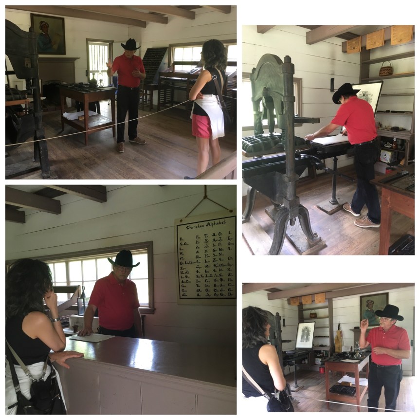
Another difference I noticed between the two visits was when visiting the Print shop, which in my mind is probably the highlight of the who park; last time, visitors were allowed full access to the print shop to the extent that children and parents were even allowed try their hand at using the printing machine (under supervision)
This time, we were kept firmly behind various barriers (one being a rope extended across the work space), even thought there were only two of us, both adults. And when the guy printed something he did not ask us if we wanted to try our hand.
That said, I did learn a bunch of interesting printing related fact from him, a collection of everyday phrases that were inspired by printing,
Worth a good two hours, possibly more, both attractions are on a man-made island. In the valleys near this location sat both a Colonial era British Fort, and an Indian village that was the birthplace of a Famous Native American; the original valley locations for both the fort and village were submerged in 1979, in order to create the Tellico reservoir, and island.
I came here wanting to see Sequoyah’s birthplace, having been told about this it by the folks at New Echota in Georgia, where there is a whole display describing his achievements. Sequoyah was so famous in his day that the trees of the same name were named after him; he achieved this notoriety because, after recognizing the importance of the written language in empowering the invading whites, he sat down and all by himself invented a phonic alphabet for the Cherokee language so that his people too could be literate. And the village in which he was born was called Tuskegee
Below a plaque in memory of the Cherokee people who had lived in the valley that had been flooded in 1979, and the 191 burial sites that had to be moved to this new burial mound in order to create the Tellico reservoir
I am putting this on the list of places that I didn’t schedule in near enough time for. I honestly was expecting it to be less than it was. By the time I was getting there, it was due to close in about 10 minutes. I had the phone number and called, and the lady working the desk said she would stick around for an extra 15 for me, and another Family that happened to show up can see the place at the same time I arrived (they had not called).
As I said before, this is not actually the original location, the Tennessee Valley Authority had flooded the whole area to create a electric damn and this is where they move to the his home, and created the visitor’s center which explains all about the history of the tribes, and the import of Sequoyah’s achievements.
Once this place closed, I moved across the street to the rebuilt British fort built there. By the time I arrived the visitor’s center had already close, so I can’t speak to it.
Behind the visitor’s center however is the fort, which only closes at sundown… and it is kind of seriously cool. It’s a living history museum which includes everything, down to sheets on the soldiers bunks
To be blunt, this is a “not yet ready for prime time” educational center about the Cherokee nation and the ‘Trail of Tears,’ which passed along the old ‘highway’ (aka, historic paved road) the center sits next to. According to the woman who ran the place, they’re still getting funding and were just recently able to buy this building (which looks like it might have been some sort of office). The plan is to tear down the current structure, in the very near future — just a matter of months, and replace it with a much larger facility on the same location.
Currently, all they really have to show are some placards on the wall that tell the story of what happened, which are (I’m pretty sure) duplicates of ones I already saw on the walls of other more developed locations like New Echota (I’m guessing they were gifts from a state historical society or some such). She said that once they expand there will also be artifacts from local digs and research facilities, with a full library, etc. Among the placards was a description of archeological digs done in the area before the Tennessee Valley Authority had put in a damn that flooded many historic Indian sites back in the 1930’s as part of the depression area development of the region, and I assume many of the artifacts will be from those digs.
I look forward to coming back to this place at some later date to see how it progresses.
When I first drove here, I thought that maybe my GPS had failed me, because there were no signs leading to here, but happily, there are nice clear signs out front. Then I saw the sign on the door… firstly, the author forgot to include the local area code and not being a from there I had no idea what to dial, and secondly, my T-mobile phone had no signal, as in none. I went next door to the gas station and asked a nice young guy if he had a working cell phone and would he please call the number for me. The woman who runs the place was apparently 15 minutes away running errands, but said to wait for her.
While doing that, I went next door to a nice looking antiques place (other people’s junk), which actually had a few things worth buying, as a well a huge collection of abandoned family photographs that go back to the 1800’s (we don’t recognize any of these relatives so what will you pay us for them). It was kind of sad actually. The woman who ran the place gave me a free copy of a book about the history of the area written by a local man.
A memorial to, and attempted recreation of, the former capitol of the Cherokee nation (before it was uprooted and moved west during by President Andrew Jackson‘s trail of tears — one of the more disturbing events in US history).
I have very mixed feelings about places like this. On one hand, its good to see the dirty linen being laid out in the open, an attempt at some sort of ‘mea culpa‘ by the people of Georgia (yes our forefathers were dirt bags) … on the other hand, it’s a state park, and this benefits the state of Georgia and helps bring tourist dollars to the area. Because, let’s be real, the state of Georgia, and the ‘founders’ of the town of Calhoun, GA are the same people who eradicated the town in the fist place (of course with the help of Jackson, everyone’s favorite president–NOT!) and while I’m glad they built/are building this place, and I doubt it’s much of a money maker… I question the motives that created it as much as I appreciate the results.What I would have liked to see but didn’t (which does not mean it isn’t happening, just that it wasn’t front and center in the museum) evidence that tribal elders are somehow involved in this site, etc.
However, that said…
The New Echota site and museum is open Thurs-Sat, the web site says it’s open on Wednesdays, but the one time I went there on that day it was closed. The visitor’s center includes a small museum, and a 17 minute movie (also visible here) but most of it is outdoors, where they have tried to recreate some of what was there, and you are left to walk it alone at your own pace (as such, it’s better for a nice weather excursion). It’s a Georgia State park and marks some of the land that was supposedly the location of the national Capitol of the Cherokee nation before they were forcibly removed during the Trail of Tears. Counter to the Hollywood stereotype, they lived in western type wood homes, grew crops, had their own written language developed by Sequoyah, their own newspaper which had a world wide distribution (according to the docent), and literacy within the nation actually was higher than among the surrounding white communities (but at the time that wasn’t all that hard to achieve). During my second visit there (when it was open) It was Spring Break for a lot of the schools around the country, so there were a lot of kids and parents even though it was mid week.
Essentially its part of the land that they historically know the town was built on, and they’ve managed to rebuild a few of the building, etc., except for the home of the local missionary, which I believe may still be the original although massively refurbished. According to the docent the most accurate re-building is the printing house, because the soldiers who destroyed it had thrown all the metal print blocks out the windows before burning the place, and when archeologists did a dig they found them marking an almost perfect square on the ground. In addition the state’s historian had found that the missionary had sent in highly detailed requests for what had been needed to build the place, so that there are records of how many nails, sheets of wood, dimensions, etc.
One of the really cool things about the place is there’s a website they’ve created with a narrated walking tour for almost every building on the site that you can load to your smartphone/tablet at the ‘entrance building’, and then pull up each description when you reach that particular building.
Highly educational restored home that will blow away historically inaccurate, Hollywood based, preconceived notions of who Native Americans were in the early 1800’s.
If you are in the area and have little hard knowledge regarding the original inhabitants of what is now the United States of America, than I strongly suggest a visit to this historic house if only because it may help to destroy some of your misconceptions regarding who the Cherokee were at the time of the trail of tears (1838-1839).
Most Westerners (and in this I include Americans and Europeans), based on what they have learned from Hollywood films, etc., seem to believe that all Native Americans were backward, or refusing to integrate into western society and that was the reason they were moved westward to what was called the “Indian Territories”, but this is woefully incorrect. In actuality, the reason the native inhabitants were removed had more to do the the recent discover of gold in their lands in 1829. The historic location I visited today is the restored home of Chief Van, a Native American so rich that he owned at least 100 slaves, a bunch of paddle wheel river boats, many trading posts, etc.
He was one of the influential Native Americans of the time who were using the American Judicial system to fight for the rights of his people, and with varying degrees of success in that regard (think of this as the first time that America Judiciary and the southern states came into direct conflict with each other — a pattern later repeated with civil rights, abortion, and then gay rates, et al). In spite of all of his wealth, and power, he made the major tactical error of hiring a white overseer when it was illegal for an Indian to do so (the states had been passing laws restricting the rights of native Americans that were not all that dissimilar to the segregation laws after the civil law, or to what Hilter later did to the Jews in Germany) thereby giving the federal government cause to kick him out along with the rest of the Cherokee during the trail of tears (only he took all of his furniture, slaves, etc. with him and continued to be very rich).
The house is SO fancy that it had a floating staircase and a fancy interior paint job with pigments most people of the day could never have afforded, and president Monroe had spent the night there when visiting the area.
After I leaving the house I drove past the first swamp I saw in Georgia. According to the docent at the Vann house, Spring Place which is the town where the house is located is the poorest part of the state, I guess this was the proof.
While the Indian mound is essentially a mildly offensive tourist trap, the tiny village of Sautee — just down the street — is in my opinion well worth the visit:
Located in Georgia, just outside of Helena, there is this Indian mound that really impressed me, at least until I learned from online sources (such as Atlas Obscura) that it had already been excavated, and then replaced (and is therefore a replica rather than the original) — a fact that none of the signs at the location tell you … nor one shared with me by locals.
The area in which it sits could best be described as countrified yuppie. It’s all gift shops and locally made artesian soaps cheeses and art etc., none of whom I suppose have any motivation to tell the truth about historical mound their shops are adjacent to. Not only did the locals not share the actual facts with me, I was, I would argue, actively misled by them. I can’t remember if it was the saleswoman at the racist antiques store across the street (which sold Sambo dolls and ‘Song of the South‘ DVD’s) or one of the other locals business people who initially assured me that the mound was an Indian burial mound that had been kept in “almost pristine condition” in large part because of the gazebo that a local farmer had opted to place on the top, that kept him and future farmers from leveling it.
In fact, if you look closely and read the sign, and then go to this site, you’ll discover that the sign is mostly a pack of lies!!!! There is no evidence that DeSoto visited, and archeologists are fairly certain that the mound predates any Cherokee habitation of the area.
Consider for instance “legend” that is associated to the mound:
“The legend of the Nacoochee Indian Mound states that Indian lovers from opposing tribes are buried within the mound. Sautee, a brave of the Chicksaw Tribe, and Nacoochee, the daughter of a Cherokee Chief fell immediately and hopelessly in love when a Chicksaw band stopped in Cherokee territory at a designated resting place. The two lovers met in the night and ran away to nearby Yonah Mountain to spend a few idyllic days together. When they later confronted Nacoochee’s father with the idea of creating peace between the two nations, Chief Wahoo ordered Sautee thrown from the high cliffs of Yonah Mountain while Nacoochee was forced to watch. Almost immediately, Nacoochee broke away from her father’s restraining hands and leaped from the cliff to join her lover. At the foot of the cliff, the lovers dragged their broken bodies together and locked in a final embrace and died there. The Chief, overcome with remorse realized the greatness of love and buried the lovers, still locked in death, near the banks of the Chattahoochee River as a burial mound.”
source: Southernhighroads.org
Seems a bit TOO Romeo and Juliet for my tastes… that and the fact that the mound is listed on the National registry of historical places may, in actuality, have more to do with it’s having been located on the estate of L.C. Hardman, a former Georgia Governor, than anything else. … none of which I learned till I started researching the location for this blog post.
I have to say that in retrospect, as someone who has deep personal connections to the Native American community, I felt a bit ‘ripped off’ by my experience at this location. On the upside, it’s not someplace I went out of my way to see, it just happened to be along the drive… but that said, some honesty would be appreciated! I suppose I shouldn’t have been surprised, considering this is located just outside of Helen, GA, (notable only for German architecture and restaurants — only one of which is any good — it is essentially a tourist trap aimed at anyone in search of a little touch of a Bavaria in the midst of the Appalachian foothills).
That said, directly adjacent is one of the actual gathering points (of which there were many) for the Trail of Tears… a forced relocation (that for those Native Americans not affluent enough to purchase transit devolved into an ultimately genocidal/ethnic cleansing) of the south eastern United states, during the administration of Andrew Jackson.
That said, I did find one major “FIND” a bit further down Unicoi turnpike… first you’ll find a very cute “village/crossroads” (not more than few stores) of Sautee Nacoochee which includes the ridiculously picturesque Old Sautee’s Store and market,
walking distance from which you’ll find the Folk Pottery Museum of Northeast Georgia, a museum for the Traditional pottery of the area, built as an annex to a converted historic school, which now serves as the Sautee Nacoochee Center, a gallery and visual arts center for local artists (and a lot of what they have for sale — and at affordable prices considering it’s original art… are, at least in my opinion, really good)