Located right off of Historic Route 66 as it meanders through the town of Rolla Missouri and passed the Missouri University of Science and Technology, is a half sized version of Stonehenge, similar to the one on in Amesbury on the famous Salisbury Plain of England.
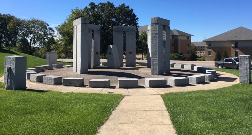
Sometimes referred to as the Stubby Stonehenge, according to their website the structure this ‘functional art’ ….


… works just the same way that the original Stonehenge, as a solar calendar… only in this case it comes with annotations in the form of etchings into the stone and plaques placed on the various rocks… and it
“stands for many things; a lasting monument to man’s drive for knowledge and engineering, the largest monument to ever be cut with a water-jet, and a link from the past into the modern. It was dedicated on June 20, 1984 or the summer solstice, at the site of the northwest edge of campus. Approximately 160 tons of granite were used in the monument. The rock was cut to the proper dimensions by Missouri S&T’s Water-jet equipment.”
According to other websites, it was mostly something to do to show off how good their High Pressure Water Jet Lab was at stone carving. Although I also found an FAQ page put up about the place by the University

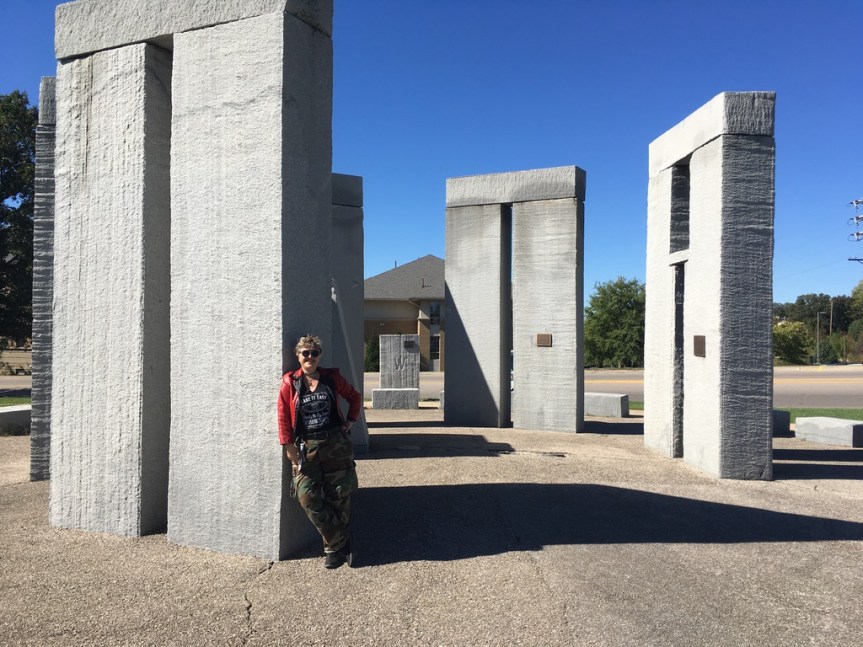
Somehow I did not spot this on any of the preparatory maps that I used when planning this Route 66 road-trip… so to just happen to drive by it, unexpectedly… it was a super cool surprise…. it made the geek in me very happy…..
Of course this also gives me opportunity to include some images I took back on July 3, 2014, when I was at the REAL prehistoric Stonehenge site near Amesbury … less than a month before my father died. I had gone to the UK to present an academic research paper at a conference at Keele University near Stoke-on-Trent, and afterwards had gone to visit a friend of mine who USED to work for Google in SF (she was on the team the created Google mail) but who had grabbed her golden parachute when her stock options matured a few years before, and had retired to Bristol in the UK, about an hour drive away from Stonehenge.

[My T-shirt reads: “English doesn’t borrow from other languages. English follows other languages down dark alleys, knocks them over and goes through their pockets for loose grammar.” Why yes, I’m a geek, what’s your point?]
I remember that I got there late, and didn’t make it in time to actually be able to enter the site. I had “assumed” (never assume) that closing time meant closing time… it doesn’t. For Stonehenge the LAST admission to the site is TWO HOURS before the place closes, and they only let in a limited number of people at a time, so unless you’re very lucky, you’ll need to book your visit in advance (from this site), which I had not done… not to mention I showed up a half hour before closing. When I got there the guard refused me entry and told me to come back some other day, and to book my admission rather than just showing up. I almost cried… when I explained I was American and this was my last chance before heading home… he made a suggestion. He told me to drive around the henge area, to a gravel side road on the far side of the tourist entrance, where I would see a lot of other parked cars. From there, he said I could at least see it better. So I drove there… and met this new age-ie guy, making a mini- henge with rocks he found on the road…. [The paved road visible via google maps is NOT accessible to public traffic, it’s for tourist busses only]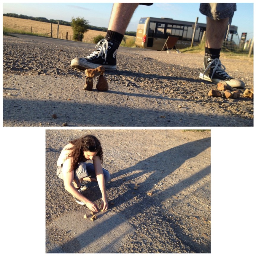
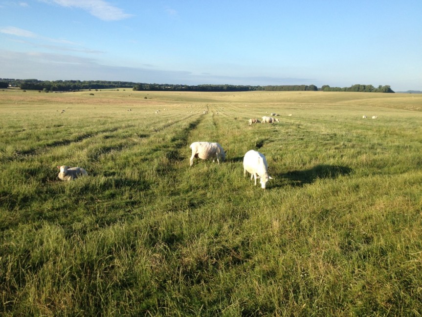
There were in fact a LOT of new age types parked along this gravel road… they had a sort of mini community thing going on over there. Since then Folks have even noted its location in google maps, and if you zoom in you’ll see a LOAD of cars along that road, parked for free instead of in the paid lot. They ALL suggested that I walk down to the edge of the official property, at which point there’s a pedestrian accessible wooden gate to his property, with some warning signs on it about keeping your dog on a short leash and respecting that you’re on private property, etc., that opens to a path along the edge of his sheep farm and along the official Stonehenge property … and they promised me that the farmer who owns the place actually wants folks crossing his property to get a closer look — they said it was a sort of “fuck you” to the English Heritage Trust government folks — that was as long as you don’t mess with his sheep.
The ironic thing is… IF you go in the official way, while you do access to the educational tourist center, which is supposedly quite good (I have not yet seen it) … that’s not what you’re paying to see. What you’re really wanting is to get close to Stonehenge — but no one is allowed to do that anymore except on days like Solstice and other Pagan festival day like that. Somewhere we’ve got photos of when my brother and I were very young children (so like 50 years ago) and our parents took us to Stonehenge. In them you can see him on one of the rocks (I was still a toddler). But those days are LONG past… Today, ironically, the distance between this free path, and the path you’ll be paying to walk along is little enough as ‘never mind’. That said, the free way limits you to one side of the henge, while the paid path takes you all around it… but pretty much at an equidistant.
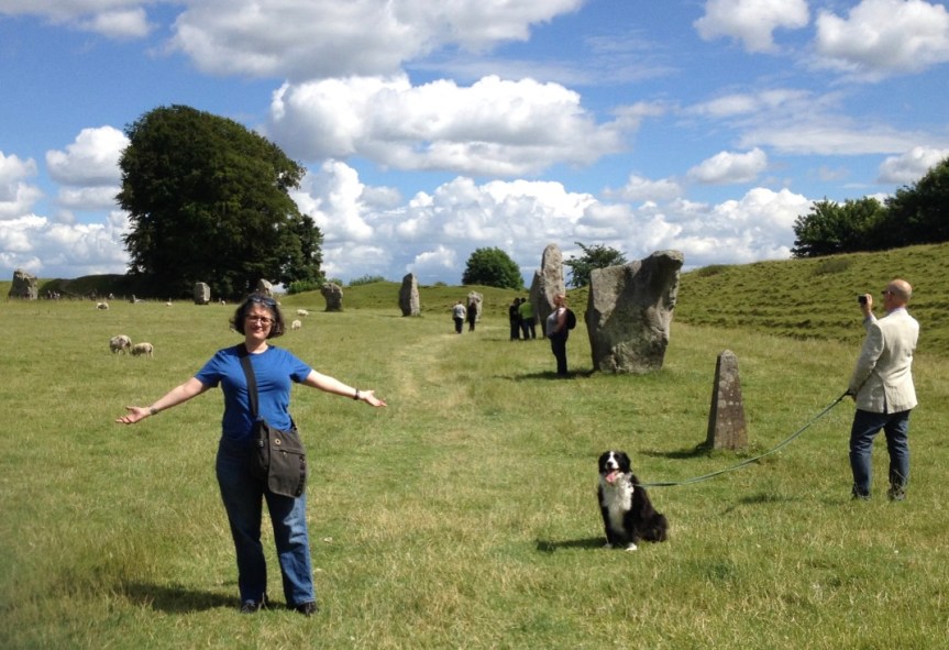
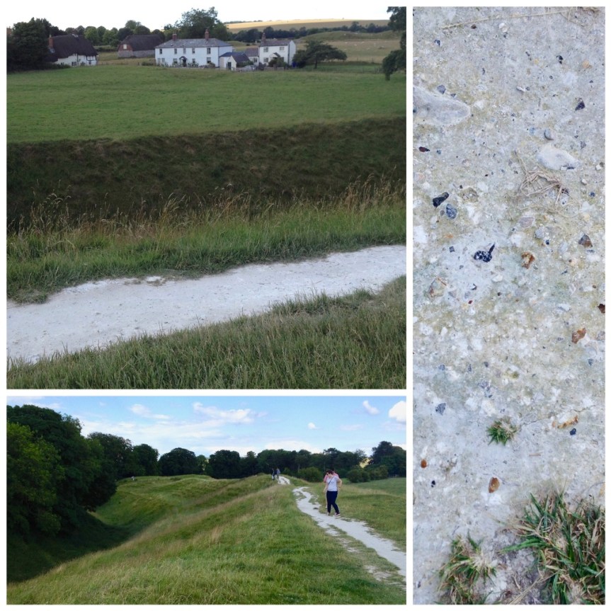
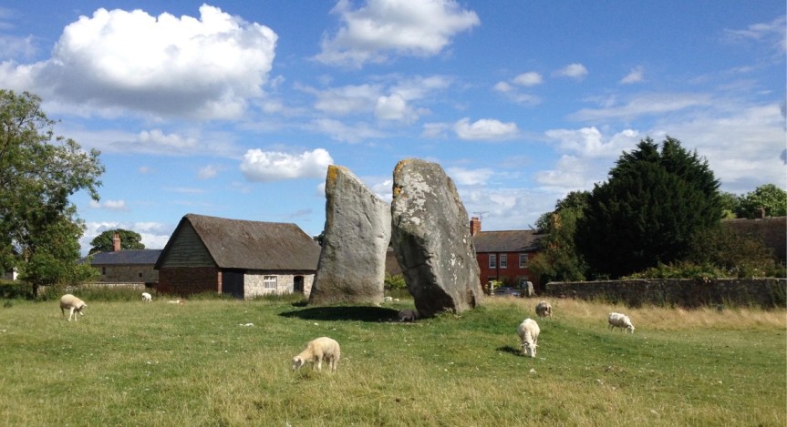
That said, three days later on July 6th, 2014, my friend who I was staying with in Bristol (she’s the one standing, wearing a backpack, with her back to the stone in the picture above) took me to an arguably more interesting, albeit less famous, prehistoric henge directly north of Stonehenge in Avebury, on what is debatably the northern edge of the Salisbury Plain (the actual edges of the plain are up for debate). This henge, which the public can STILL visit entirely for FREE and get up close and personal with the stones, is actually the largest Neolithic stone circle in Europe (in terms of ground covered). Unlike Stonehenge, which has the largest stones and as such is famous for the “how the fuck did pre-technology man get stones this big to this location?” question, that has in the past made people think aliens must have done it… This henge consists mostly groundworks, that encircle very large stones (but of the, “ok, I can see how primitive man working together might have moved these to here” size).
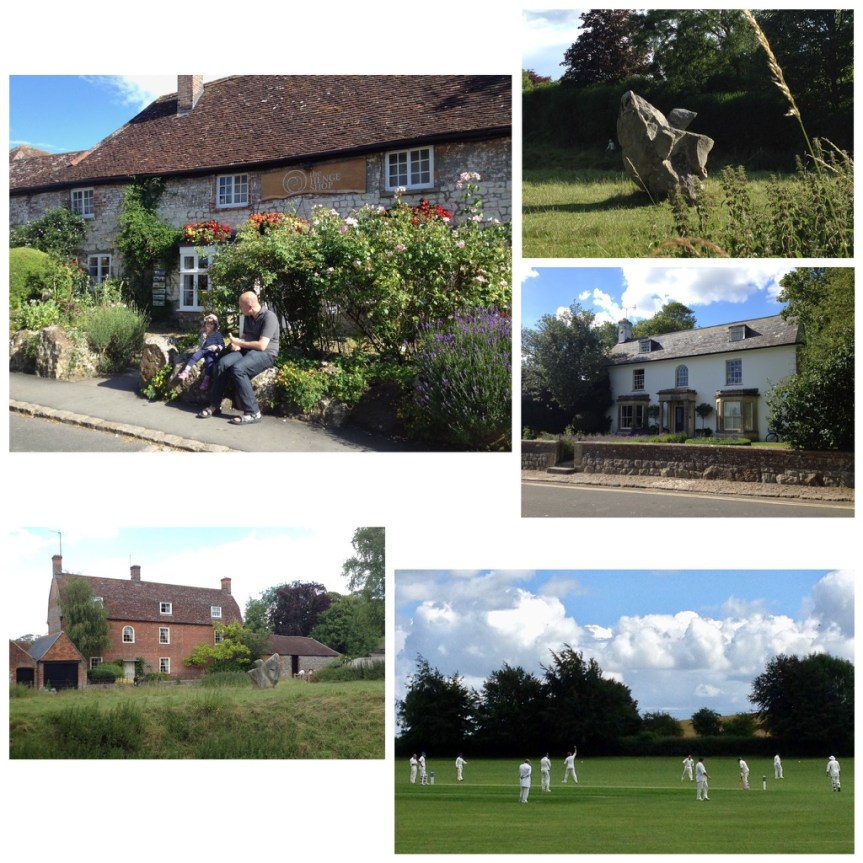
Here, and I was shocked when I first realized this — and you can’t but, I noticed it as soon as we drove to the location, the village actually cuts THROUGH the center of this historic henge, so that some homes actually have henge rocks in their gardens….
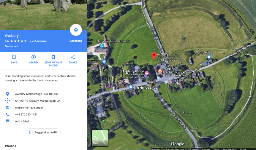
This is most easily seen via a satellite shot, like via google maps (see above), or from an aerial shot from a drone or plane…. like the one that heads this English Heritage Trust’s website for Avebury (click-through to see it).

Note the road I was on when I took the photo cuts right through the circle, and the shot below is of the same location from a slightly different angle (you can tell from the church spires) only in the 2nd one I was up on top of one of the ground-works
In a way looking at these is sort of bitter-sweet for me. Unbeknownst to me, my father was having real health issues back in the states but he refused to tell me about them because he didn’t want me cutting my trip to England (he was British by birth) short on his account. MEN!
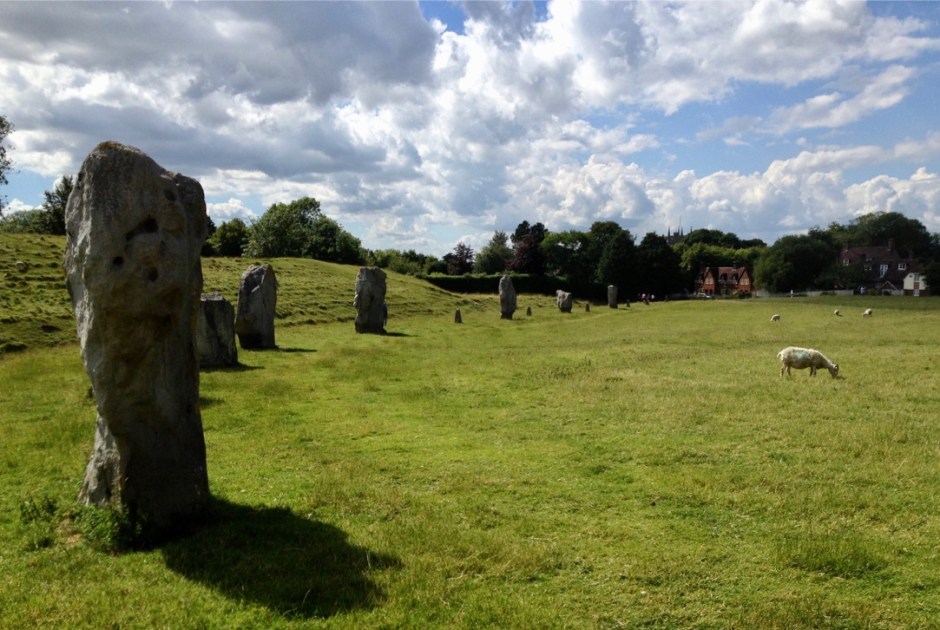

As is obvious from the above picture, this prehistoric area is actively used by locals for hiking and picnics, etc.

and it’s really easy to see how the ground was worked by prehistoric man, with both dug trenches into the chalk ground (which must have been very hard work) and then used that to make man-made mounds surrounding them