

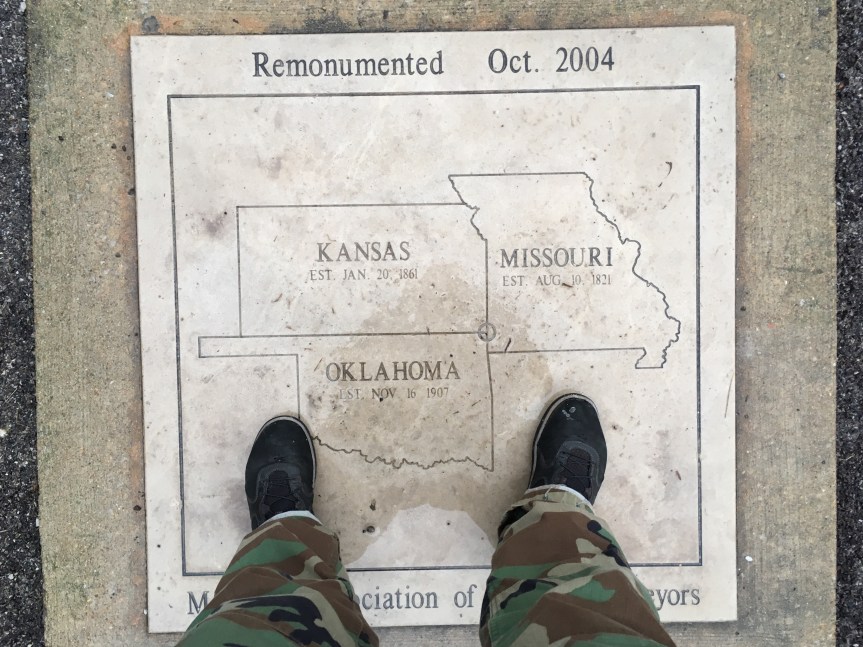
This is what it says it is… within the borders of Joplin (MO) there is a fairly well hidden marker (not far off the old 66 route) that marks a spot where three states meet: Oklahoma, Kansas and Missouri. That said, it is seriously NOT easy to find. My car’s GPS couldn’t find it, and ultimately I had to resort to google maps (which won’t work if you don’t have data coverage in that area)
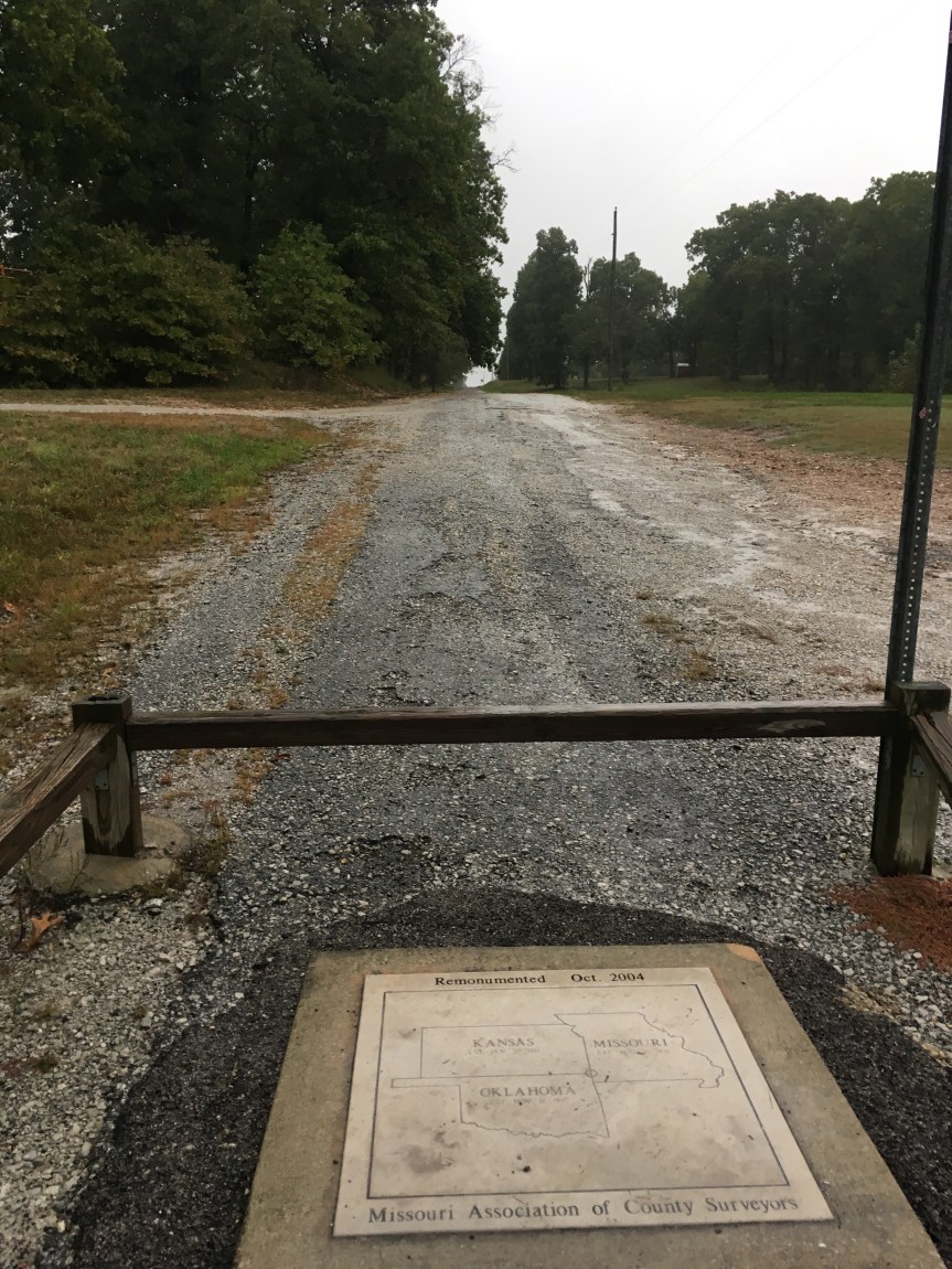
It is located down very old heavily pot-holed (seriously, watch out or you’ll screw up the alignment of your wheels) road that is more gravel than asphalt, just off a roundabout. And alongside a large pillar (there’s nothing ON said pillar to explain why it’s there).

I have a feeling that the reason the road is in such disrepair is because it’s sort of a no-mans land… the road to the monument lies RIGHT on the Missouri/Kansas border… although google maps puts it JUST at the edge of Missouri.
[Am I the only one who always get confused between Missouri, MO…. Montana is MT … Massachusetts, MA and Mississippi, MS]
