A Grave in the middle of the Road, Franklin IN

This is one of those historic oddities that make for a nice pit stop during a long drive. It is quite literally a grave that is located in the middle of a side road that led off to some very pretty farm land.

img_6763

Among the sources I used when planning my trips, there’s a web-page/iPhone app resource that I use, called Roadtrippers.com where you can load in your destinations, and the application/web site will pop up a list of all the various things you might want to consider stopping at along the way (in its “oddities” category, which I love). You chose the ones you want, and then on your iPhone you load the list… HOWEVER, I have also found that the addresses appended to those locations are NOT always correct, so it’s best to then double check them with google. (For instance, the next day I went to the Louisville Slugger museum, and got misdirected to a residential neighborhood in seemed to be the worst part of Louisville, although based on the myriad of signs it was also the neighborhood where Muhammad Ali, formerly known as Cassius Clay, had been born.) This time however the address was true, and my GPS device in my car led me to it no problems, only the whole look of the place had changed.

Previously, as evidenced by some of the videos and photos I found, there had been an actual grave that stood above the road level

                         —– (borrowed Image by: Tony FramptonTumblrfound on Urban Ghosts)

And above the grave there was a fancy marker sign that had read:

Nancy Kerlin Barnett
Born May 14, 1793 – Died Dec. 1, 1831
Married to William Barnett. Feb. 29, 1808 [I did the math, she was 14]
He was born Sept. 27, 1786 [he was 22]
[He?] Drowned in the Ohio River Sept. 24, 1854
William was the great, great, great grandson of Pocahontas and John Rolfe.
Daniel G. Doty, 1846-1934, protected his grandmother’s grave by staying here with his gun, while the county relocated this cemetery in order to build the road. A concrete slab was placed over the grave to protect the marker, Aug. 8, 1912.

[and then in much smaller type]
Erected in 1982, by Kenneth F. Blackwell
Great, great grandson [of Doty?], and his son
Richard Blackwell

However, as evidenced by my photos, by the time I got there this had all been bull dozed flat (including the marker), and replaced by a far less interesting grave-marker embedded into a concrete lane divider — which granted, is arguably far more practical for the locals who drive by the place daily:

img_6764

To my pleasure, however, I also discovered that the grave-site was a pokestop (I’m currently obsessed with Pokémon go), and it was the photo for that (another reason I love this game) that first allowed me to see the now missing sign and learn a bit more about how the surrounding cemetery had been moved.

NONE of this information was now available at the site!!!!!!

img_6765

While I was sitting there, playing the game on my smartphone, figuring out where and wanted to go next, and reserving myself a hotel room for the night — God BLESS smartphones, anyone remember the hassle of tripdix from AAA back when they were printouts? —  a local guy in a pickup truck drove by me, stopped, and said he was concerned that maybe I needed help. He seemed highly amused that ANYONE would be interested enough in the site to actually drive here intentionally — I honestly don’t think the county really considered the tourism possibilities when they restructured the area… there weren’t even any signs out on the main road leading to this location.

Later that night, when I had stopped for the night and started to write this blog post I was able to pull up more information about the site, such as how the site had been restored to meet current traffic needs

To some disturbing things they discovered when the archeologists from the local University had finished investigating it (they got WAY more than they were bargaining for … literally).

In fact, keeping in mind the story that the Daniel G. Doty had protected the grave with a shot gun, and refused to allow them to move it, you have got to wonder if maybe the family had previously committed some murders, and hidden the bodies in grandma’s grave… and he knew that, and THAT was why he was so crazy adamant about not allowing the body to moved.

Located @ 6844 E 400 S, Franklin, IN 46131

Victoria B.C.’s Fisherman’s wharf

Cute place, but you get the feeling they developed it mostly because tourists kept asking, “where is the fisherman’s wharf.” Not worth making a special trip to unless you’ve got ample time, there’s better seafood joints elsewhere.

IMG_4123

I’d heard that Victoria had a fisherman’s wharf, but I didn’t really bother about going there till after I had already taken two different bus tours, both or which had pointed it out as a place to go.

To put it bluntly, it was inconveniently far from a walking point of view. Looking at the map below, you can see where the wharf is relative to my Airbnb apartment, which is in Chinatown, ( or about two blocks north of the bridge). Now, considering that it takes me about 20 minutes to walk from my digs to the legislature building, that adds up to the wharf being almost a full hours walking distance, or, to far to not take some sort of transportation — which I’ve been avoiding. (Let me just note that keeping my car in the garage and relying mostly on my feet to get around, combined with a diet that in majority has consisted of steamed or grilled fish, has resulted in me going down one pants size in two weeks!) However, after my second bus tour had dropped me off in front of the Empress Hotel at about 3:45, and I was tired, and cabs line up at the Empress; I decided it was too early to go home, so I grabbed a cab and paid about $8 (Canadian = $6.96 US after the 3% foreign transaction fee) for ride over there. (Granted, from there it was a walk-able distance, but like I said I was already tuckered out.)

IMG_4124

As fisherman wharfs go, this one is kind of tiny. To it’s credit, is an actual fisherman’s wharf, in that fisherman still dock their boats there and locals can buy fresh catches from them, specifically Dungeness Crab, which is slightly ironic as I’ve only seen this sort of crab sold in one restaurant the whole time I’ve been here (a Chinese place).

IMG_4234

But to get to where these boats are you’ll have to negotiate past all the tourist trap shops, which sell food, rent canoes, and offer whale watching tours; well that, or enter the wharf from a walkway at the far end, i.e., no where near the parking lot.

IMG_4254

IMG_4253

IMG_4187

Just past all the business are a large collection of houseboats, which kind of confused me. Having lived in the San Francisco area for many years I was more than familiar with houseboats, I even have a few friends and acquaintances who live on them… and the think is that usually houseboats are not cheek to jowl with tourist areas, for obvious reasons. So on one hand while I felt kind of sorry for the folks living in these ones (practically every house was decorated with ‘PRIVATE’ and “Trespassers will be Eaten” signs, and the like) the fact is they knowingly signed up for the invasion of their privacy… which makes me wonder if the city of Victoria (or the wharf) doesn’t offer some sort of economic incentives to keep them moored there.

IMG_4244

Once upon a time I lived in an apartment whose living room balcony opened up to canals, so that we had a gorgeous view of sailboat from our living room, and a multi-million dollar estate just across the way (complete with a yacht that could house more people than our apartment building). So I could totally get into living on a houseboat moored next to sailboats, but I’m not sure I’d be as sanguine about being able to watch airplanes take off and land from my living room window.

IMG_4247

On the upside, this wharf meets my current culinary restrictions, as I can easily find seafood that is either raw, or cooked with the bare minimum of oil (I have a fatty liver and borderline diabetes, so it’s no longer about vanity dieting).

For my late lunch (4pm) I had three buck-a-shuck oysters and a cup of a cream free halibut chowder, which had an Indian curry flavor to it, which was ok but didn’t have much halibut in it and wasn’t anything to get excited about

On the way back I grabbed one of the water taxis, which actually turned out to be cheaper than a normal one, but quite a bit (as a single traveler, $4.64 US for twice the distance, but I was able to use my Discover card so no 3% hit); although, since they charge per person I can see how a normal taxi would be cheaper if I were traveling in a group. Of course it had the added advantage of seeing the harbor from a different vantage point.

IMG_4239

Kinsol Trestle, Shwanigan Lake B.C.

Formerly a Trestle that supported a train-line on Vancouver Island, now a tourist attraction and part of the Trans-Canada hiking trail (their answer to the Appalachian Trail)

IMG_1729

Heard about this from an old guy who was training to be a docent at Shwanigan Lake’s local History museum; pretty much EVERY town and village on Vancouver Island seems to have one of these, and none of them have proven worth seeing unless you’re already there and really desperate for something to do.

IMG_1725

Having never actually seen a train trestle before, other than in the movies, I decided I’d see it but was holding on on doing it till my girlfriend Gina came to visit (we’ve known each other since kindergarten); she always complains that traveling with me never involves much walking, and this place actually demands some.

IMG_1741

While it’s pretty, and if you’re in the area it’s worth seeing, I’m not sure it’s worth a special trip for. Trains no longer run across it.

Malahat, B.C. (Scenic spots along Highway 1)

These are a collection of scenic turnoffs located on the TransCanadian Highway (#1) that are only accessible when traveling northbound from Victoria

IMG_1320

IMG_2729

I didn’t find these on any website, nor did my friend Louise, who is a local tell me about them (and we had driven right by them). Normally the traffic past them is fast, and because its a winding mountain road it’s best to keep your eyes focused on the task at hand. Luckily however, one time when I was driving it traffic was backed up a bit, and the resultant reduced speed allowed me to spot them… there are about three  of them.

IMG_2730

IMG_1314


IMG_1310

Cowichan Bay (& Mill Bay)

Cute place to stop for a meal, a bit like an affordable/low rent cousin of Sausalito, CA.

IMG_1288

Cowichan Bay is a semi-idyllic small fishing town, in a ‘crunchy granola’ sort of a way. It’s not unlike a lot of other small towns located along the west coast of the North American Continent that have made the effort to try to be touristy by adding to, rather than distracting from, their natural advantages — namely attractive vistas. Neither of the primary ferries from the mainland to Vancouver Island land here (they go either from the city of Vancouver to Nanaimo an hour north, or from Seattle to Victoria an hour south of here), but if you happen to be driving between the two and wanted to stop midway for a meal in a cute seaside town, this would be a good option. It reminds me a lot of a smaller version of Sausalito in the San Francisco Bay area, only sans the gourmet restaurants, sans the view of the city and Golden Gate bridge, and no fairly regular flow of movie stars, although (keeping on the SF comparison) the vibe here is a bit more Berkley.

That said, I’m not sure its a place worthy of a special trip, but if you are in the area anyway, and I am, it’s nice…. I came to Vancouver Island British Columbia, specifically to check out where my friend Louise grew up. She and I shared an office for two and a half years while teaching at a University in South Korea, and she often told me about how great her hometown was and how much she missed it, especially the pristine clear air. She recently returned to Mill bay, which is only about 10 minutes from here. From the balcony of her home, she has an almost unobstructed view across ~140 miles (or 230 KM) to Mount Baker (if you ignore the electrical lines)…. which from my perspective beats the crap out of anything you can see in the horribly polluted air she and I used to breath daily in S. Korea — it was not uncommon for the air to be so smoggy that I couldn’t even see the mountain located an easy walking distance from my apartment. Add to that the fact that she regularly sees seals, bald eagles, and the occational whale while walking her dogs by old growth forests and a bay …Victoria Island is fairly idyllic on the “places to live” scale, assuming you can find a decent job; so, I wanted to check it out.

IMG_1294

See the tiny woman standing in front of the almost six story tall old growth pine? That would be Louise; she was the one who suggested we come here for lunch, to a local fixture restaurant her parents used to like to come to, the Rock Cod Cafe.

IMG_1280
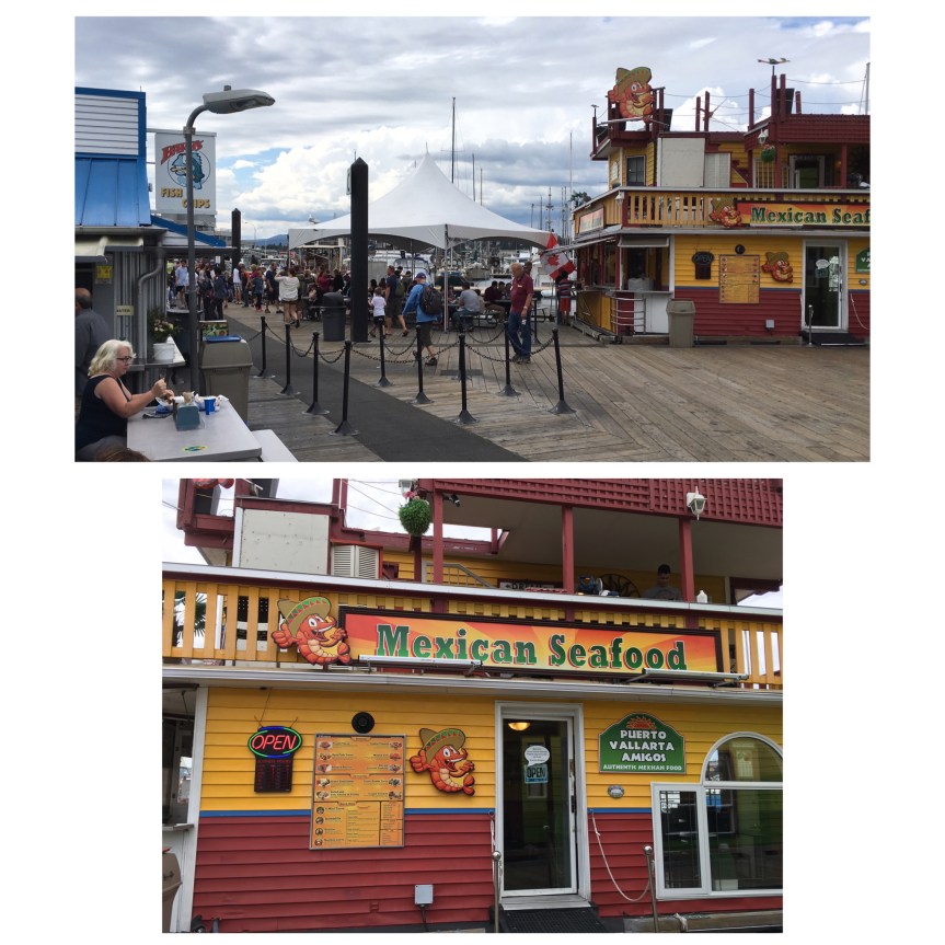
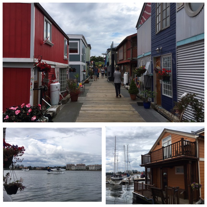
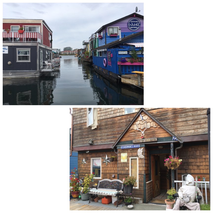
She had a bowl of fish chowder in a sourdough bread bowl, while I was forced to take the healthier option (during my last visit back to Chicago I got diagnosed with fatty liver, on top of my pre-diabetic status), so I went for the grilled Pacific Cod with prawns, with a side of veggies on a bed of rice pilaf that I could only “taste” since white rice is now verboten. Nothing about it was what I would describe as a meal worth making a special trip for, but it was simple fresh ingredients, cooked well at reasonable prices (for the area — cost of living on Islands is always a bit higher than on mainlands due to added costs for transportation and energy).

After our meal, we went directly behind the restaurant to check out the view

When I had to choose an Airbnb I was actually looking at this area and where I am — because I couldn’t find anything decent right in Mill Bay, where my friend lives. I thought the place I opted for would be a more ‘Mountain lake’ type thing cause that’s how it is advertised…but it isn’t. Apparently it’s a popular place for folks who live in Victoria to have their summer homes, but you can’t really see any mountains from Shwanigan Lake, and from my airbnb you can’t even see the lake. Add to that the fact that there’s only one semi-decent eatery in the place (and I judge places by how they eat)…  Next time I come to visit Louise, I’m thinking I’ll try to get a place here.

Note added June 14th: There are in fact a few different restaurants, here, that I’m intending to try before I leave. One that I recently tried, I feel should be avoided at all costs; it is the Ocean View restaurant, which is on the top floor of a hotel with the same name. I went there initially to check it out as a place to take two of my friends who are coming in to town for a visit. Let’s just say what shows up on the plate doesn’t compare to what’s advertised on their web site… they actually served me burnt food, and the windows were all scratched up — like someone had taken a brillo to it. Pretty sure the view on their website was taken through an open window.

Thoughts & Musings

So day before yesterday I stopped in a MASSIVE antiques store in Helen, GA (it took up all 3 floors of a huge home, described as Antebellum, and a modern extension — off to the right). What made this stop interesting, beyond the sheer size of their collection, was that at the front counter they had a large number of DVD copies of Disney’s Song of the South.

fullsizeoutput_332a

When I said to the owner, a woman, that I didn’t think they HAD released it to DVD because of how controvertial it is, she told me that they imported them from the UK (where I guess they are released). Then I mentioned how Martin Luther King himself had asked Walt Disney (himself) NOT to make the film, and if he did to PLEASE NOT show “happy singing slaves” and how Disney had ignored him on all counts, but the movie had failed at the box office because by it’s release in 1946  it was already out of step with the times …

Then, an older guy, who had overheard my comments and who stated that he was a retired cop, started talking about how they’d changed the name of the road his police station in Texas was on to Martin Luther King Drive, and how offended the cops were that they’d done it… He went on to say that the racism (push back) had just escalated from there… it was a very “interesting” conversation that would never have happened in the North.

Now in retrospect I’m thinking on it and in fact the store had IMPORTED them, and it wasn’t just one copy, it was a lot of copies… i.e., Disney might not want to release them in the the U.S., but this store owner clearly believed that there was enough demand to support the extra cost.

Oh, and before I spotted the DvD I was bemused by a relatively large collection of Sambo dolls and figurines for sale — which is something else one sometimes sees sold in other countries but rarely in the US of A.

Nacoochee Mound & Sautee Nacoochee, GA

While the Indian mound is essentially a mildly offensive tourist trap, the tiny village of Sautee — just down the street — is in my opinion well worth the visit:

fullsizeoutput_332b

Located in Georgia, just outside of Helena, there is this Indian mound that really impressed me, at least until I learned from online sources (such as Atlas Obscura) that it had already been excavated, and then replaced (and is therefore a replica rather than the original) — a fact that none of the signs at the location tell you … nor one shared with me by locals.

The area in which it sits could best be described as countrified yuppie. It’s all gift shops and locally made artesian soaps cheeses and art etc., none of whom I suppose have any motivation to tell the truth about historical mound their shops are adjacent to. Not only did the locals not share the actual facts with me, I was, I would argue, actively misled by them. I can’t remember if it was the saleswoman at the racist antiques store across the street (which sold Sambo dolls and ‘Song of the South‘ DVD’s) or one of the other locals business people who initially assured me that the mound was an Indian burial mound that had been kept in “almost pristine condition” in large part because of the gazebo that a local farmer had opted to place on the top, that kept him and future farmers from leveling it.

In fact, if you look closely and read the sign, and then go to this site, you’ll discover that the sign is mostly a pack of lies!!!! There is no evidence that DeSoto visited, and archeologists are fairly certain that the mound predates any Cherokee habitation of the area.

Consider for instance “legend” that is associated to the mound:

“The legend of the Nacoochee Indian Mound states that Indian lovers from opposing tribes are buried within the mound.  Sautee, a brave of the Chicksaw Tribe, and Nacoochee, the daughter of a Cherokee Chief fell immediately and hopelessly in love when a Chicksaw band stopped in Cherokee territory at a designated resting place.  The two lovers met in the night and ran away to nearby Yonah Mountain to spend a few idyllic days together.  When they later confronted Nacoochee’s father with the idea of creating peace between the two nations, Chief Wahoo ordered Sautee thrown from the high cliffs of Yonah Mountain while Nacoochee was forced to watch.  Almost immediately, Nacoochee broke away from her father’s restraining hands and leaped from the cliff to join her lover.  At the foot of the cliff, the lovers dragged their broken bodies together and locked in a final embrace and died there.  The Chief, overcome with remorse realized the greatness of love and buried the lovers, still locked in death, near the banks of the Chattahoochee River as a burial mound.”
source: Southernhighroads.org

Seems a bit TOO Romeo and Juliet for my tastes… that and the fact that the mound is listed on the National registry of historical places may, in actuality, have more to do with it’s having been located on the estate of L.C. Hardman, a former Georgia Governor, than anything else. … none of which I learned till I started researching the location for this blog post.

I have to say that in retrospect, as someone who has deep personal connections to the Native American community, I felt a bit ‘ripped off’ by my experience at this location. On the upside, it’s not someplace I went out of my way to see, it just happened to be along the drive… but that said, some honesty would be appreciated! I suppose I shouldn’t have been surprised, considering this is located just outside of Helen, GA, (notable only for German architecture and restaurants — only one of which is any good — it is essentially a tourist trap aimed at anyone in search of a little touch of a Bavaria in the midst of the Appalachian foothills).

That said, directly adjacent is one of the actual gathering points (of which there were many) for the Trail of Tears… a forced relocation (that for those Native Americans not affluent enough to purchase transit devolved into an ultimately genocidal/ethnic cleansing) of the south eastern United states, during the administration of Andrew Jackson.

IMG_7191

 fullsizeoutput_332c

That said, I did find one major “FIND” a bit further down Unicoi turnpike… first you’ll find a very cute “village/crossroads” (not more than few stores) of Sautee Nacoochee which includes the ridiculously picturesque Old Sautee’s Store and market,

IMG_0002

walking distance from which you’ll find the Folk Pottery Museum of Northeast Georgia, a museum for the Traditional pottery of the area, built as an annex to a converted historic school, which now serves as the Sautee Nacoochee Center, a gallery and visual arts center for local artists (and a lot of what they have for sale — and at affordable prices considering it’s original art…  are, at least in my opinion, really good)

IMG_0001